Lincoln night lights from space
Night Light of Lincoln (Nebraska) from space (United States) Src. Average luminocity for 10x10km area is 91.3316% and for 50x50km: 12.6301%.
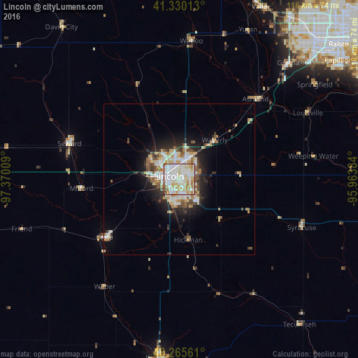
Analysis of Lincoln night lights 2016
Square area 10x10 km:
 35.54%
90-99
32.48%80-89
12.76%70-79
10.2%60-69
6.97%50-59
1.7%40-49
0.34%30-39
0%20-29
0%10-19
0%0-9
0%Square area 50x50 km:
2.78%90-99
2.9%80-89
1.68%70-79
1.4%60-69
1.35%50-59
1.3%40-49
1.18%30-39
1.4%20-29
2.71%10-19
5.03%0-9
78.25%Clear (daylight) street map image can be seen on geolist.org.
Map coordinates:
41° 19' 48.5" North, 97° 22' 12.3" West
40° 48' 0" North, 96° 40' 1.1" West
40° 15' 56.2" North, 95° 57' 49.8" West
Some cities around Lincoln sort by population:
• Papillion
65.6 km =40.8 mi,  53°
53°
• La Vista
68.3 km =42.4 mi, 51°
• Beatrice
59.5 km =37 mi,  186°
186°
• Chalco
60.8 km =37.8 mi, 45°
• Elkhorn
65.1 km =40.5 mi,  33°
33°
• Seward
38.2 km =23.7 mi,  288°
288°
• Crete
31.3 km =19.4 mi,  232°
232°
• Gretna
52.2 km =32.4 mi,  43°
43°
5072006 (p: 277,348)
Sources (retrieved 2019-11-25):
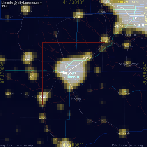
» NASA, Earths city lights 1995
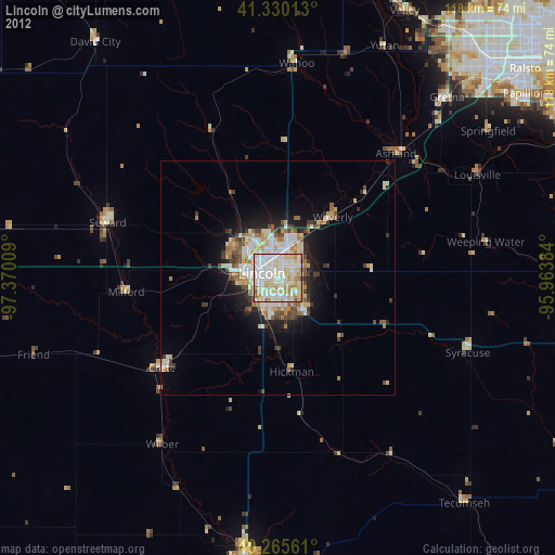
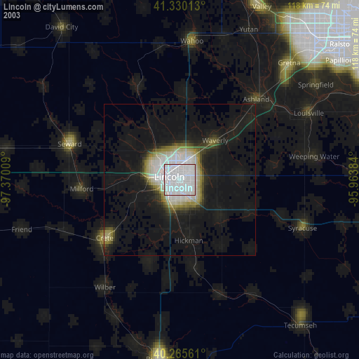
» NASA city lights 2003
» Earth at Night: Flat Maps 2012, 2016