Lawrence night lights from space
Night Light of Lawrence (Massachusetts) from space (United States) Src. Average luminocity for 10x10km area is 78.0288% and for 50x50km: 42.3318%.
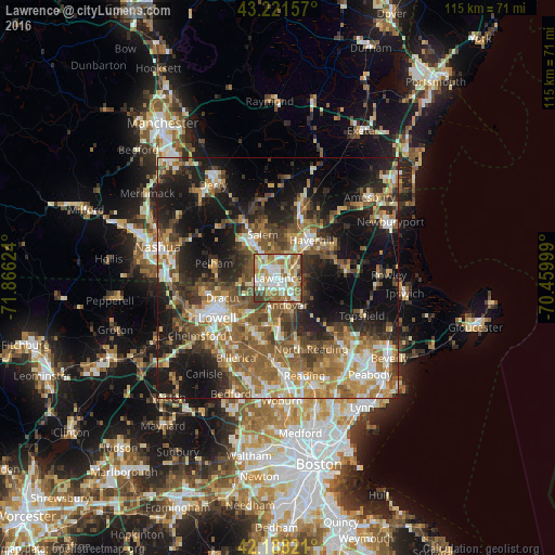
Analysis of Lawrence night lights 2016
Square area 10x10 km:
 17.88%
90-99
21.67%80-89
13.03%70-79
8.18%60-69
20.15%50-59
9.24%40-49
5%30-39
4.85%20-29
0%10-19
0%0-9
0%Square area 50x50 km:
5.27%90-99
6.83%80-89
4.92%70-79
6%60-69
8.41%50-59
9.22%40-49
6.78%30-39
6.37%20-29
10.72%10-19
19.51%0-9
15.97%Clear (daylight) street map image can be seen on geolist.org.
Map coordinates:
43° 13' 17.7" North, 71° 51' 58.5" West
42° 42' 25.3" North, 71° 9' 47.2" West
42° 11' 17.6" North, 70° 27' 36" West
Some cities around Lawrence sort by population:
• Haverhill
10.4 km =6.5 mi,  42°
42°
• Methuen
3.1 km =1.9 mi,  313°
313°
• Salem
9.6 km =6 mi,  341°
341°
• Tewksbury
12.2 km =7.6 mi,  208°
208°
• Dracut
12.1 km =7.5 mi,  250°
250°
• North Andover
2.5 km =1.6 mi,  112°
112°
• Andover
5.8 km =3.6 mi,  158°
158°
• Groveland
12.3 km =7.6 mi,  61°
61°
4941720 (p: 80,231)
Sources (retrieved 2019-11-25):
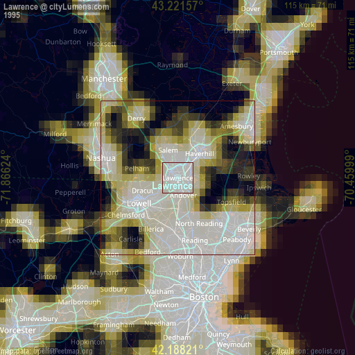
» NASA, Earths city lights 1995
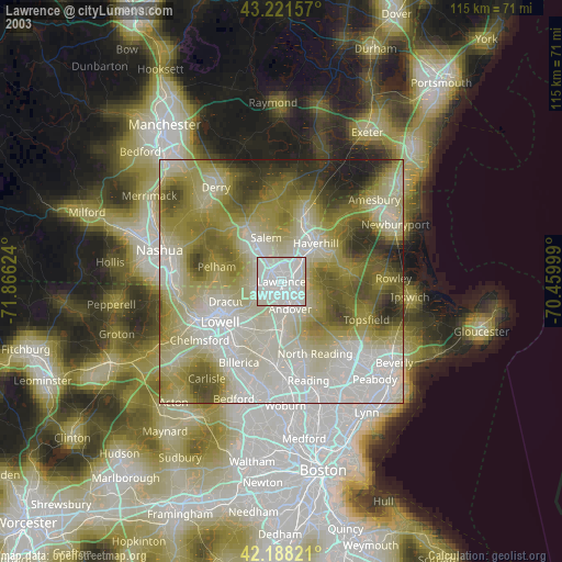
» NASA city lights 2003
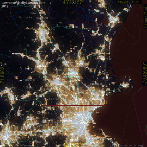
» Earth at Night: Flat Maps 2012, 2016