Hawthorne night lights from space
Night Light of Hawthorne (California) from space (United States) Src. Average luminocity for 10x10km area is 99.6906% and for 50x50km: 64.2566%.
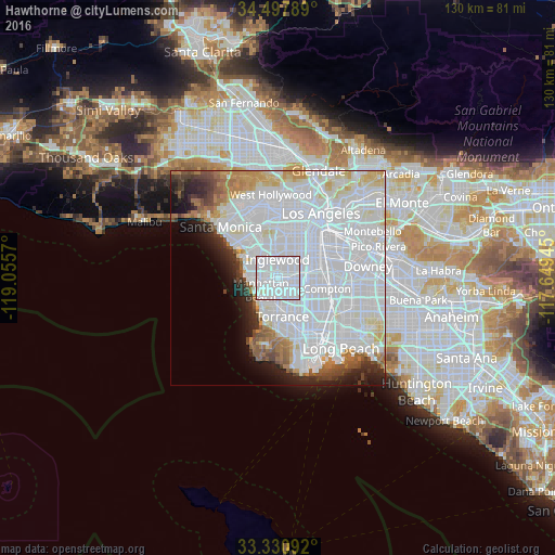
Analysis of Hawthorne night lights 2016
Square area 10x10 km:
 86.71%
90-99
12.94%80-89
0.35%70-79
0%60-69
0%50-59
0%40-49
0%30-39
0%20-29
0%10-19
0%0-9
0%Square area 50x50 km:
38.41%90-99
13.53%80-89
3.63%70-79
3.08%60-69
3.29%50-59
2.64%40-49
2.42%30-39
2.36%20-29
3.82%10-19
4.63%0-9
22.19%Clear (daylight) street map image can be seen on geolist.org.
Map coordinates:
34° 29' 52.4" North, 119° 3' 20.5" West
33° 54' 59" North, 118° 21' 9.3" West
33° 19' 51.3" North, 117° 38' 58" West
Some cities around Hawthorne sort by population:
• Inglewood
5 km =3.1 mi,  359°
359°
• Gardena
5.1 km =3.2 mi,  127°
127°
• Lawndale
3.2 km =2 mi,  180°
180°
• Westmont
5.4 km =3.4 mi,  59°
59°
• Lennox
2.4 km =1.5 mi, 359°
• Del Aire
1.6 km =1 mi,  268°
268°
• West Athens
4.6 km =2.9 mi,  80°
80°
• Alondra Park
3.6 km =2.2 mi,  146°
146°
5355828 (p: 88,451)
Sources (retrieved 2019-11-25):
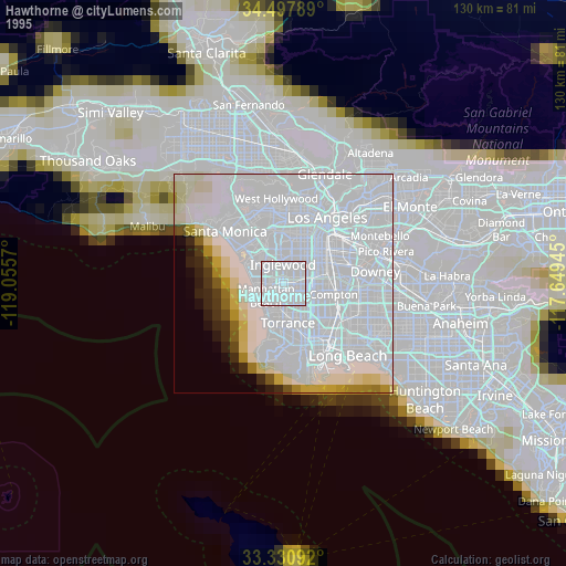
» NASA, Earths city lights 1995
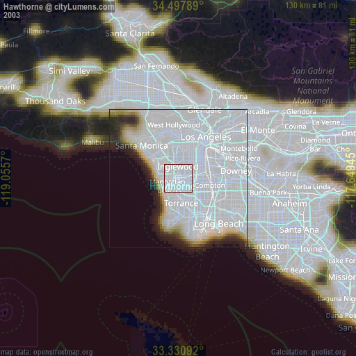
» NASA city lights 2003
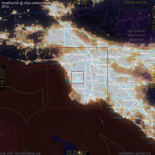
» Earth at Night: Flat Maps 2012, 2016