Landen night lights from space
Night Light of Landen (Ohio) from space (United States) Src. Average luminocity for 10x10km area is 75.8197% and for 50x50km: 48.6723%.
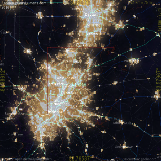
Analysis of Landen night lights 2016
Square area 10x10 km:
 19.22%
90-99
18.54%80-89
7.99%70-79
14.46%60-69
13.44%50-59
14.29%40-49
5.44%30-39
5.27%20-29
1.36%10-19
0%0-9
0%Square area 50x50 km:
10.07%90-99
11.11%80-89
6.6%70-79
9.16%60-69
8.05%50-59
7.56%40-49
4.43%30-39
4.87%20-29
5.18%10-19
5.67%0-9
27.29%Clear (daylight) street map image can be seen on geolist.org.
Map coordinates:
39° 51' 14" North, 84° 59' 10" West
39° 18' 43.2" North, 84° 16' 58.8" West
38° 45' 57.1" North, 83° 34' 47.5" West
Some cities around Landen sort by population:
• Mason
5.8 km =3.6 mi,  336°
336°
• Sharonville
12.2 km =7.6 mi,  246°
246°
• Loveland
5.1 km =3.2 mi,  160°
160°
• Blue Ash
12.1 km =7.5 mi,  222°
222°
• Goshen
13.6 km =8.5 mi,  129°
129°
• Montgomery
11.2 km =7 mi,  213°
213°
• Beckett Ridge
13.7 km =8.5 mi,  286°
286°
• Kenwood
13.4 km =8.3 mi, 212°
4516248 (p: 6,782)
Sources (retrieved 2019-11-25):
» Earth at Night: Flat Maps 2012, 2016