Goshen night lights from space
Night Light of Goshen (Ohio) from space (United States) Src. Average luminocity for 10x10km area is 20.1395% and for 50x50km: 34.4507%.
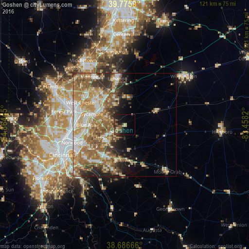
Analysis of Goshen night lights 2016
Square area 10x10 km:
 0%
0%90-99
1.02%80-89
1.7%70-79
4.08%60-69
1.02%50-59
8.33%40-49
5.44%30-39
3.4%20-29
6.97%10-19
18.54%0-9
49.49%Square area 50x50 km:
5.14%90-99
6.84%80-89
4.77%70-79
6.13%60-69
7.2%50-59
7.46%40-49
3.78%30-39
3.56%20-29
4.75%10-19
5.55%0-9
44.81%Clear (daylight) street map image can be seen on geolist.org.
Map coordinates:
39° 46' 33.2" North, 84° 51' 52" West
39° 14' 0.2" North, 84° 9' 40.8" West
38° 41' 12" North, 83° 27' 29.5" West
Some cities around Goshen sort by population:
• Loveland
9.7 km =6 mi,  294°
294°
• Montgomery
16.6 km =10.3 mi,  267°
267°
• Madeira
18.1 km =11.2 mi,  254°
254°
• Kenwood
17.9 km =11.1 mi,  261°
261°
• Milford
13.2 km =8.2 mi,  240°
240°
• Landen
13.6 km =8.5 mi,  309°
309°
• The Village of Indian Hill
16.1 km =10 mi, 248°
• Summerside
18 km =11.2 mi,  217°
217°
4512940 (p: 11,644)
Sources (retrieved 2019-11-25):
» Earth at Night: Flat Maps 2012, 2016