Lake Havasu City night lights from space
Night Light of Lake Havasu City (Arizona) from space (United States) Src. Average luminocity for 10x10km area is 48.5437% and for 50x50km: 3.2598%.
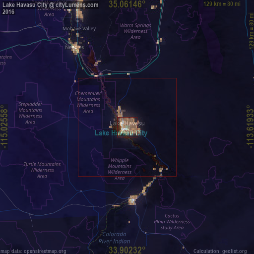
Analysis of Lake Havasu City night lights 2016
Square area 10x10 km:
 2.1%
2.1%90-99
4.55%80-89
2.27%70-79
5.59%60-69
13.29%50-59
34.97%40-49
6.82%30-39
4.02%20-29
5.07%10-19
20.8%0-9
0.52%Square area 50x50 km:
0.08%90-99
0.18%80-89
0.09%70-79
0.3%60-69
0.98%50-59
1.73%40-49
0.48%30-39
0.4%20-29
0.43%10-19
2.62%0-9
92.69%Clear (daylight) street map image can be seen on geolist.org.
Map coordinates:
35° 3' 41.3" North, 115° 1' 32.1" West
34° 29' 2" North, 114° 19' 20.8" West
33° 54' 8.4" North, 113° 37' 9.6" West
Some cities around Lake Havasu City sort by population:
• Bullhead City
77.2 km =48 mi,  343°
343°
• Kingman
82.2 km =51.1 mi,  17°
17°
• Twentynine Palms
163.7 km =101.7 mi,  256°
256°
• Blythe
100.4 km =62.4 mi,  194°
194°
• New Kingman-Butler
90.8 km =56.4 mi, 16°
• Golden Valley
82.7 km =51.4 mi,  6°
6°
• Laughlin
79.4 km =49.3 mi, 343°
• Wickenburg
157.2 km =97.7 mi,  111°
111°
5301388 (p: 53,553)
Sources (retrieved 2019-11-25):
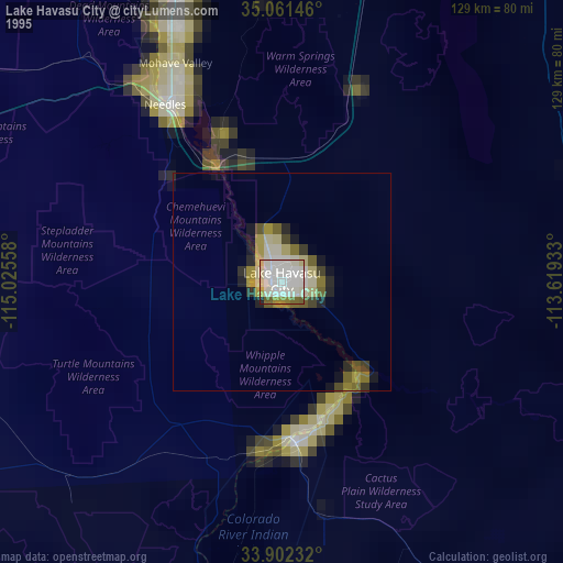
» NASA, Earths city lights 1995
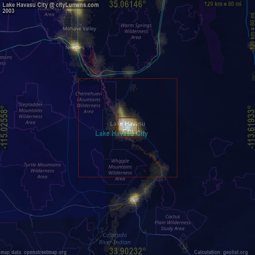
» NASA city lights 2003
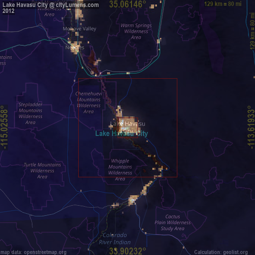
» Earth at Night: Flat Maps 2012, 2016