Twentynine Palms night lights from space
Night Light of Twentynine Palms (California) from space (United States) Src. Average luminocity for 10x10km area is 15.2985% and for 50x50km: 1.506%.

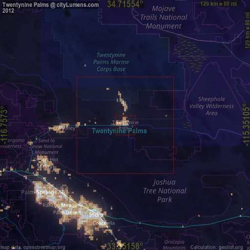
Analysis of Twentynine Palms night lights 2016
Square area 10x10 km:
 0%
0%90-99
0%80-89
0%70-79
0.55%60-69
7.51%50-59
5.68%40-49
4.95%30-39
3.85%20-29
0.55%10-19
0.55%0-9
76.37%Square area 50x50 km:
0.03%90-99
0.09%80-89
0.02%70-79
0.08%60-69
0.69%50-59
0.44%40-49
0.35%30-39
0.24%20-29
0.02%10-19
0.17%0-9
97.88%Clear (daylight) street map image can be seen on geolist.org.
Map coordinates:
34° 42' 55.9" North, 116° 45' 26.3" West
34° 8' 8" North, 116° 3' 15" West
33° 33' 5.7" North, 115° 21' 3.8" West
Some cities around Twentynine Palms sort by population:
• Indio
48.5 km =30.1 mi,  198°
198°
• Coachella
51.8 km =32.2 mi,  192°
192°
• Desert Hot Springs
45.7 km =28.4 mi,  244°
244°
• Yucca Valley
34.9 km =21.7 mi,  266°
266°
• Thousand Palms
46.8 km =29.1 mi,  221°
221°
• Garnet
52.2 km =32.4 mi, 240°
• Joshua Tree
23.8 km =14.8 mi, 269°
• Bermuda Dunes
48.8 km =30.3 mi,  206°
206°
5404198 (p: 26,025)
Sources (retrieved 2019-11-25):
» Earth at Night: Flat Maps 2012, 2016