Golden Valley night lights from space
Night Light of Golden Valley (Arizona) from space (United States) Src. Average luminocity for 10x10km area is 4.1573% and for 50x50km: 3.4893%.
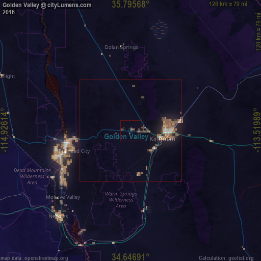
Analysis of Golden Valley night lights 2016
Square area 10x10 km:
 0%
0%90-99
0%80-89
0%70-79
0%60-69
1.05%50-59
1.4%40-49
1.57%30-39
2.62%20-29
1.4%10-19
0.35%0-9
91.61%Square area 50x50 km:
0.16%90-99
0.27%80-89
0.2%70-79
0.31%60-69
0.87%50-59
1.24%40-49
0.67%30-39
0.74%20-29
0.53%10-19
2.69%0-9
92.31%Clear (daylight) street map image can be seen on geolist.org.
Map coordinates:
35° 47' 44.4" North, 114° 55' 34.1" West
35° 13' 24" North, 114° 13' 22.8" West
34° 38' 48.9" North, 113° 31' 11.6" West
Some cities around Golden Valley sort by population:
• Henderson
113.8 km =70.7 mi,  322°
322°
• Lake Havasu City
82.7 km =51.4 mi,  186°
186°
• Bullhead City
32.5 km =20.2 mi,  255°
255°
• Whitney
121.9 km =75.7 mi, 322°
• Kingman
15.9 km =9.9 mi,  103°
103°
• Boulder City
100.4 km =62.4 mi,  326°
326°
• New Kingman-Butler
17.9 km =11.1 mi,  75°
75°
• Laughlin
32.4 km =20.1 mi, 259°
5296189 (p: 8,370)
Sources (retrieved 2019-11-25):
» Earth at Night: Flat Maps 2012, 2016