Kew Gardens night lights from space
Night Light of Kew Gardens (New York) from space (United States) Src. Average luminocity for 10x10km area is 99.9805% and for 50x50km: 70.8823%.
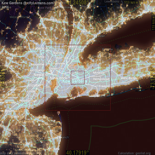
Analysis of Kew Gardens night lights 2016
Square area 10x10 km:
 98.05%
90-99
1.95%80-89
0%70-79
0%60-69
0%50-59
0%40-49
0%30-39
0%20-29
0%10-19
0%0-9
0%Square area 50x50 km:
40.13%90-99
15.42%80-89
4.24%70-79
4.61%60-69
4.16%50-59
3.08%40-49
2.67%30-39
2.52%20-29
4.43%10-19
6.38%0-9
12.34%Clear (daylight) street map image can be seen on geolist.org.
Map coordinates:
41° 14' 42.3" North, 74° 32' 2.8" West
40° 42' 51.4" North, 73° 49' 51.5" West
40° 10' 45.1" North, 73° 7' 40.3" West
Some cities around Kew Gardens sort by population:
• Queens
3.7 km =2.3 mi,  187°
187°
• Jamaica
3.3 km =2.1 mi,  139°
139°
• Richmond Hill
1.6 km =1 mi,  180°
180°
• Forest Hills
1.6 km =1 mi,  277°
277°
• Briarwood
1.4 km =0.9 mi,  112°
112°
• Rego Park
2.3 km =1.4 mi,  306°
306°
• Woodhaven
3.6 km =2.2 mi,  219°
219°
• Hillside
3.8 km =2.4 mi,  100°
100°
5123344 (p: 18,983)
Sources (retrieved 2019-11-25):
» Earth at Night: Flat Maps 2012, 2016