Kemp Mill night lights from space
Night Light of Kemp Mill (Maryland) from space (United States) Src. Average luminocity for 10x10km area is 88.414% and for 50x50km: 75.874%.
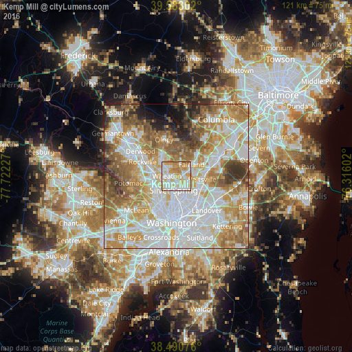
Analysis of Kemp Mill night lights 2016
Square area 10x10 km:
 24.35%
90-99
30.36%80-89
18.02%70-79
17.21%60-69
9.9%50-59
0.16%40-49
0%30-39
0%20-29
0%10-19
0%0-9
0%Square area 50x50 km:
23.83%90-99
18.34%80-89
10.15%70-79
12.78%60-69
10.79%50-59
8.22%40-49
4.74%30-39
4.09%20-29
3.13%10-19
2.48%0-9
1.44%Clear (daylight) street map image can be seen on geolist.org.
Map coordinates:
39° 34' 58.9" North, 77° 43' 20.2" West
39° 2' 20.4" North, 77° 1' 8.9" West
38° 29' 26.7" North, 76° 18' 57.7" West
Some cities around Kemp Mill sort by population:
• Wheaton
3.1 km =1.9 mi,  271°
271°
• White Oak
2.3 km =1.4 mi,  87°
87°
• Colesville
4.3 km =2.7 mi,  20°
20°
• Glenmont
3.4 km =2.1 mi,  308°
308°
• North Kensington
4.7 km =2.9 mi,  258°
258°
• Four Corners
2.1 km =1.3 mi,  165°
165°
• Forest Glen
4.1 km =2.5 mi,  228°
228°
• Hillandale
4.1 km =2.5 mi,  109°
109°
4359721 (p: 12,564)
Sources (retrieved 2019-11-25):
» Earth at Night: Flat Maps 2012, 2016