Junction City night lights from space
Night Light of Junction City (Oregon) from space (United States) Src. Average luminocity for 10x10km area is 4.9667% and for 50x50km: 8.3606%.
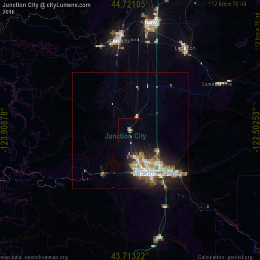
Analysis of Junction City night lights 2016
Square area 10x10 km:
 0.15%
0.15%90-99
0.45%80-89
0.91%70-79
0.3%60-69
0%50-59
2.42%40-49
0.61%30-39
0.61%20-29
0.61%10-19
0.61%0-9
93.33%Square area 50x50 km:
1.44%90-99
1.81%80-89
0.9%70-79
0.94%60-69
1.16%50-59
1.22%40-49
0.87%30-39
0.98%20-29
2.47%10-19
4.22%0-9
83.97%Clear (daylight) street map image can be seen on geolist.org.
Map coordinates:
44° 43' 15.8" North, 123° 54' 31.6" West
44° 13' 9.4" North, 123° 12' 20.3" West
43° 42' 47.6" North, 122° 30' 9.1" West
Some cities around Junction City sort by population:
• Eugene
20.9 km =13 mi,  152°
152°
• Springfield
24.2 km =15 mi,  142°
142°
• Corvallis
38.7 km =24 mi,  353°
353°
• Albany
47.1 km =29.3 mi,  9°
9°
• Lebanon
42.5 km =26.4 mi,  33°
33°
• Cottage Grove
48.3 km =30 mi,  166°
166°
• Sweet Home
42.3 km =26.3 mi,  62°
62°
• Creswell
36.5 km =22.7 mi,  156°
156°
5734198 (p: 5,842)
Sources (retrieved 2019-11-25):
» Earth at Night: Flat Maps 2012, 2016