Joplin night lights from space
Night Light of Joplin (Missouri) from space (United States) Src. Average luminocity for 10x10km area is 77.8418% and for 50x50km: 12.8688%.
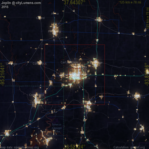
Analysis of Joplin night lights 2016
Square area 10x10 km:
 22.62%
90-99
24.49%80-89
9.52%70-79
6.46%60-69
12.41%50-59
10.37%40-49
5.27%30-39
4.93%20-29
3.57%10-19
0.34%0-9
0%Square area 50x50 km:
1.37%90-99
1.72%80-89
1.75%70-79
1.48%60-69
1.7%50-59
2.34%40-49
1.81%30-39
2.82%20-29
3.61%10-19
8.82%0-9
72.56%Clear (daylight) street map image can be seen on geolist.org.
Map coordinates:
37° 38' 35.1" North, 95° 12' 59.1" West
37° 5' 3.2" North, 94° 30' 47.8" West
36° 31' 16.5" North, 93° 48' 36.6" West
Some cities around Joplin sort by population:
• Pittsburg
40.1 km =24.9 mi,  334°
334°
• Carthage
20.7 km =12.9 mi,  60°
60°
• Miami
39.9 km =24.8 mi,  234°
234°
• Neosho
27.2 km =16.9 mi,  151°
151°
• Webb City
8.2 km =5.1 mi,  32°
32°
• Monett
54.8 km =34.1 mi,  108°
108°
• Carl Junction
11.3 km =7 mi,  335°
335°
• Grove
59.1 km =36.7 mi,  202°
202°
4392768 (p: 51,818)
Sources (retrieved 2019-11-25):
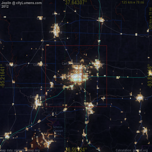
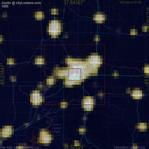
» NASA, Earths city lights 1995
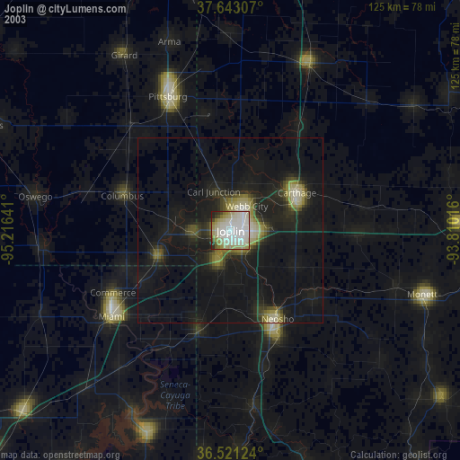
» NASA city lights 2003
» Earth at Night: Flat Maps 2012, 2016