Grove night lights from space
Night Light of Grove (Oklahoma) from space (United States) Src. Average luminocity for 10x10km area is 33.9487% and for 50x50km: 4.2284%.
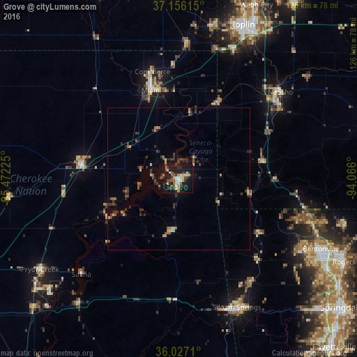
Analysis of Grove night lights 2016
Square area 10x10 km:
 2.01%
2.01%90-99
4.76%80-89
7.51%70-79
5.31%60-69
2.75%50-59
4.4%40-49
3.48%30-39
9.89%20-29
5.86%10-19
42.12%0-9
11.9%Square area 50x50 km:
0.1%90-99
0.27%80-89
0.68%70-79
0.5%60-69
0.52%50-59
0.61%40-49
0.63%30-39
1.7%20-29
1.14%10-19
2.71%0-9
91.14%Clear (daylight) street map image can be seen on geolist.org.
Map coordinates:
37° 9' 22.1" North, 95° 28' 20.1" West
36° 35' 37.3" North, 94° 46' 8.8" West
36° 1' 37.6" North, 94° 3' 57.6" West
Some cities around Grove sort by population:
• Bentonville
55.8 km =34.7 mi,  116°
116°
• Bella Vista
46.2 km =28.7 mi,  105°
105°
• Siloam Springs
49.5 km =30.8 mi,  155°
155°
• Miami
32.7 km =20.3 mi,  342°
342°
• Neosho
47.1 km =29.3 mi,  49°
49°
• Centerton
50.5 km =31.4 mi, 121°
• Pryor
58.4 km =36.3 mi,  237°
237°
• Vinita
34.7 km =21.6 mi,  278°
278°
4538126 (p: 6,751)
Sources (retrieved 2019-11-25):
» Earth at Night: Flat Maps 2012, 2016