Jennings night lights from space
Night Light of Jennings (Louisiana) from space (United States) Src. Average luminocity for 10x10km area is 30.9126% and for 50x50km: 4.2226%.
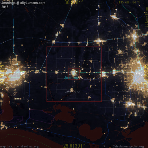
Analysis of Jennings night lights 2016
Square area 10x10 km:
 2.8%
2.8%90-99
4.9%80-89
6.64%70-79
1.4%60-69
4.55%50-59
5.42%40-49
3.15%30-39
5.42%20-29
2.27%10-19
42.83%0-9
20.63%Square area 50x50 km:
0.13%90-99
0.25%80-89
0.83%70-79
0.42%60-69
0.48%50-59
0.78%40-49
0.75%30-39
1.04%20-29
0.9%10-19
3.09%0-9
91.33%Clear (daylight) street map image can be seen on geolist.org.
Map coordinates:
30° 49' 41.2" North, 93° 21' 36.8" West
30° 13' 20.7" North, 92° 39' 25.5" West
29° 36' 46.8" North, 91° 57' 14.3" West
Some cities around Jennings sort by population:
• Lake Charles
52.6 km =32.7 mi,  268°
268°
• Crowley
27.2 km =16.9 mi,  91°
91°
• Abbeville
57.3 km =35.6 mi,  118°
118°
• Moss Bluff
52 km =32.3 mi,  279°
279°
• Eunice
38 km =23.6 mi,  37°
37°
• Scott
54.1 km =33.6 mi, 88°
• Carencro
59.3 km =36.8 mi,  79°
79°
• Rayne
37.4 km =23.2 mi, 87°
4329037 (p: 10,180)
Sources (retrieved 2019-11-25):
» Earth at Night: Flat Maps 2012, 2016