Abbeville night lights from space
Night Light of Abbeville (Louisiana) from space (United States) Src. Average luminocity for 10x10km area is 43.1402% and for 50x50km: 18.8955%.
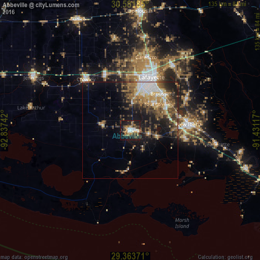
Analysis of Abbeville night lights 2016
Square area 10x10 km:
 5.49%
5.49%90-99
7.39%80-89
4.36%70-79
8.14%60-69
4.36%50-59
7.01%40-49
9.09%30-39
7.2%20-29
10.23%10-19
33.52%0-9
3.22%Square area 50x50 km:
2.64%90-99
2.36%80-89
2.41%70-79
2.49%60-69
3.03%50-59
3.34%40-49
3.61%30-39
3.76%20-29
4.53%10-19
11.18%0-9
60.66%Clear (daylight) street map image can be seen on geolist.org.
Map coordinates:
30° 34' 54.7" North, 92° 50' 14.7" West
29° 58' 28.7" North, 92° 8' 3.4" West
29° 21' 49.4" North, 91° 25' 52.2" West
Some cities around Abbeville sort by population:
• Lafayette
29.8 km =18.5 mi,  21°
21°
• New Iberia
30.6 km =19 mi,  83°
83°
• Crowley
35.3 km =21.9 mi,  319°
319°
• Youngsville
19.6 km =12.2 mi,  44°
44°
• Broussard
25.4 km =15.8 mi, 40°
• Scott
29.3 km =18.2 mi,  7°
7°
• Rayne
31.7 km =19.7 mi,  335°
335°
• Saint Martinville
33.4 km =20.8 mi,  59°
59°
4314295 (p: 12,434)
Sources (retrieved 2019-11-25):
» Earth at Night: Flat Maps 2012, 2016