Scott night lights from space
Night Light of Scott (Louisiana) from space (United States) Src. Average luminocity for 10x10km area is 77.5455% and for 50x50km: 33.5417%.
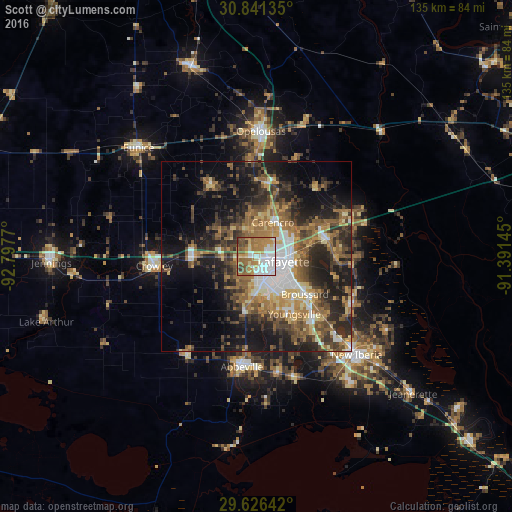
Analysis of Scott night lights 2016
Square area 10x10 km:
 24.83%
90-99
14.16%80-89
6.12%70-79
14.16%60-69
21.5%50-59
11.19%40-49
4.9%30-39
3.15%20-29
0%10-19
0%0-9
0%Square area 50x50 km:
4.97%90-99
3.62%80-89
3.64%70-79
4.48%60-69
6.83%50-59
6.73%40-49
6.35%30-39
6.67%20-29
9.55%10-19
15.81%0-9
31.34%Clear (daylight) street map image can be seen on geolist.org.
Map coordinates:
30° 50' 28.9" North, 92° 47' 51.7" West
30° 14' 8.7" North, 92° 5' 40.5" West
29° 37' 35.1" North, 91° 23' 29.2" West
Some cities around Scott sort by population:
• Lafayette
7.3 km =4.5 mi,  100°
100°
• Crowley
27 km =16.8 mi,  264°
264°
• Youngsville
18.2 km =11.3 mi,  146°
146°
• Broussard
16.2 km =10.1 mi,  127°
127°
• Carencro
10.1 km =6.3 mi,  25°
25°
• Breaux Bridge
19.2 km =11.9 mi,  77°
77°
• Rayne
16.7 km =10.4 mi,  269°
269°
• Saint Martinville
27.9 km =17.3 mi,  116°
116°
4341033 (p: 9,018)
Sources (retrieved 2019-11-25):
» Earth at Night: Flat Maps 2012, 2016