Irving Park night lights from space
Night Light of Irving Park (Illinois) from space (United States) Src. Average luminocity for 10x10km area is 100% and for 50x50km: 65.2745%.
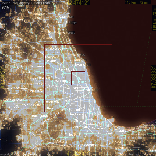
Analysis of Irving Park night lights 2016
Square area 10x10 km:
 100%
100%90-99
0%80-89
0%70-79
0%60-69
0%50-59
0%40-49
0%30-39
0%20-29
0%10-19
0%0-9
0%Square area 50x50 km:
36.97%90-99
16.3%80-89
6.65%70-79
3.41%60-69
1.84%50-59
1.54%40-49
1.43%30-39
1.5%20-29
2.02%10-19
2.92%0-9
25.43%Clear (daylight) street map image can be seen on geolist.org.
Map coordinates:
42° 28' 26.8" North, 88° 26' 22.5" West
41° 57' 12.1" North, 87° 44' 11.2" West
41° 25' 41.9" North, 87° 1' 60" West
Some cities around Irving Park sort by population:
• Belmont Cragin
3.6 km =2.2 mi,  227°
227°
• Logan Square
4.5 km =2.8 mi,  137°
137°
• Portage Park
2.4 km =1.5 mi,  281°
281°
• Albany Park
2 km =1.2 mi,  32°
32°
• Lincoln Square
4.6 km =2.9 mi,  57°
57°
• Avondale
2.6 km =1.6 mi,  127°
127°
• North Center
4.8 km =3 mi,  89°
89°
• Lincolnwood
5.7 km =3.5 mi,  5°
5°
4897543 (p: 56,520)
Sources (retrieved 2019-11-25):
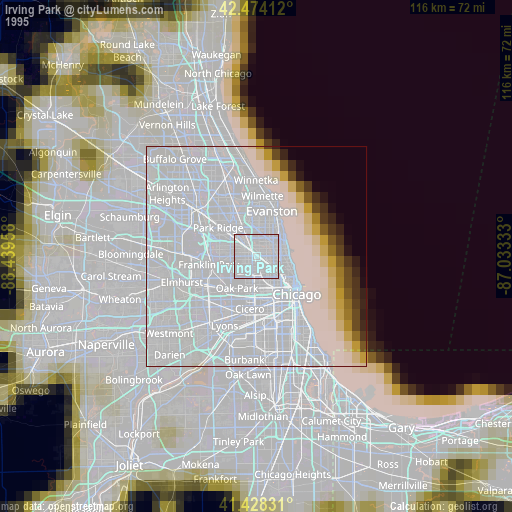
» NASA, Earths city lights 1995
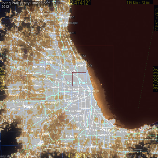
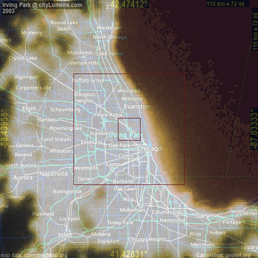
» NASA city lights 2003
» Earth at Night: Flat Maps 2012, 2016