Irving night lights from space
Night Light of Irving (Texas) from space (United States) Src. Average luminocity for 10x10km area is 94.4755% and for 50x50km: 91.2611%.
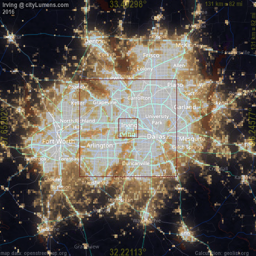
Analysis of Irving night lights 2016
Square area 10x10 km:
 40.91%
90-99
37.24%80-89
9.97%70-79
11.36%60-69
0.52%50-59
0%40-49
0%30-39
0%20-29
0%10-19
0%0-9
0%Square area 50x50 km:
39.3%90-99
30.92%80-89
11.4%70-79
9.35%60-69
5.28%50-59
2.27%40-49
0.95%30-39
0.53%20-29
0%10-19
0%0-9
0%Clear (daylight) street map image can be seen on geolist.org.
Map coordinates:
33° 24' 10.7" North, 97° 39' 7.3" West
32° 48' 50.5" North, 96° 56' 56" West
32° 13' 16.1" North, 96° 14' 44.8" West
Some cities around Irving sort by population:
• Dallas
13.7 km =8.5 mi,  104°
104°
• Grand Prairie
8.8 km =5.5 mi,  211°
211°
• Carrollton
16.5 km =10.3 mi,  19°
19°
• Euless
12.7 km =7.9 mi,  281°
281°
• Coppell
16.8 km =10.4 mi,  338°
338°
• Farmers Branch
13.4 km =8.3 mi, 21°
• University Park
14.5 km =9 mi,  73°
73°
• Highland Park
14.8 km =9.2 mi,  81°
81°
4700168 (p: 236,607)
Sources (retrieved 2019-11-25):
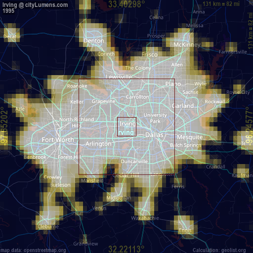
» NASA, Earths city lights 1995
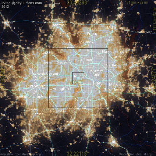
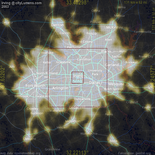
» NASA city lights 2003
» Earth at Night: Flat Maps 2012, 2016