Dallas night lights from space
Night Light of Dallas (Texas) from space (United States) Src. Average luminocity for 10x10km area is 98.9353% and for 50x50km: 86.4654%.
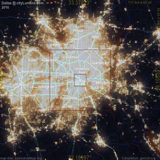
Analysis of Dallas night lights 2016
Square area 10x10 km:
 73.6%
73.6%90-99
21.68%80-89
4.55%70-79
0.17%60-69
0%50-59
0%40-49
0%30-39
0%20-29
0%10-19
0%0-9
0%Square area 50x50 km:
35.54%90-99
27.99%80-89
10.02%70-79
9.12%60-69
7.16%50-59
3.91%40-49
1.74%30-39
1.17%20-29
1.03%10-19
1.11%0-9
1.21%Clear (daylight) street map image can be seen on geolist.org.
Map coordinates:
33° 22' 20" North, 97° 30' 35.3" West
32° 46' 59" North, 96° 48' 24" West
32° 11' 23.9" North, 96° 6' 12.8" West
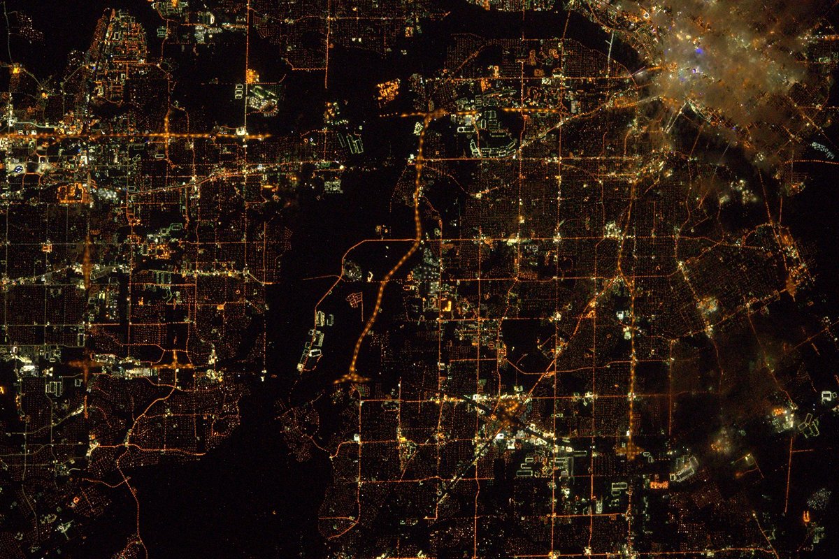
Fantastic image of Dallas from space taken by astronauts [src2], but I don't have information about it's orientation, scale or angle. If necessary, it was rotated manually, so North points approximately to upper direction. Click to zoom in:
Some cities around Dallas sort by population:
• Irving
13.7 km =8.5 mi,  284°
284°
• Grand Prairie
18.3 km =11.4 mi,  257°
257°
• Duncanville
17.4 km =10.8 mi,  213°
213°
• Farmers Branch
18 km =11.2 mi,  332°
332°
• Balch Springs
18.2 km =11.3 mi,  109°
109°
• University Park
7.5 km =4.7 mi,  4°
4°
• Highland Park
5.8 km =3.6 mi,  13°
13°
• Hutchins
17.3 km =10.7 mi,  149°
149°
4684888 (p: 1,300,092)
Sources (retrieved 2019-11-25):
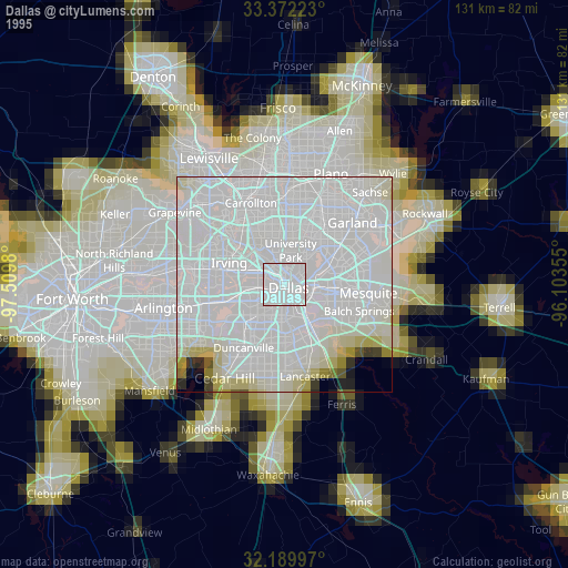
» NASA, Earths city lights 1995
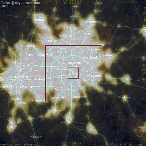
» NASA city lights 2003
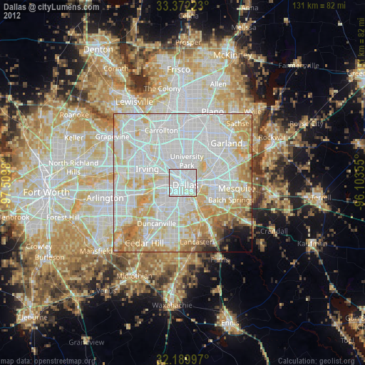
» Earth at Night: Flat Maps 2012, 2016
Src.2: Tim Kopra, Twitter/@astro_tim, 2016-05-19