Iowa Falls night lights from space
Night Light of Iowa Falls (Iowa) from space (United States) Src. Average luminocity for 10x10km area is 13.6635% and for 50x50km: 1.5866%.
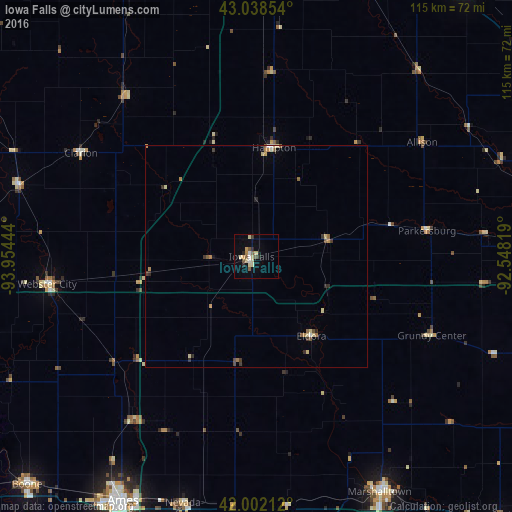
Analysis of Iowa Falls night lights 2016
Square area 10x10 km:
 0.95%
0.95%90-99
1.11%80-89
4.92%70-79
1.59%60-69
0.32%50-59
2.86%40-49
0.95%30-39
0.63%20-29
2.54%10-19
2.54%0-9
81.59%Square area 50x50 km:
0.09%90-99
0.1%80-89
0.48%70-79
0.18%60-69
0.2%50-59
0.35%40-49
0.13%30-39
0.24%20-29
0.3%10-19
0.13%0-9
97.81%Clear (daylight) street map image can be seen on geolist.org.
Map coordinates:
43° 2' 18.7" North, 93° 57' 16" West
42° 31' 20.9" North, 93° 15' 4.7" West
42° 0' 7.6" North, 92° 32' 53.5" West
Some cities around Iowa Falls sort by population:
• Ames
62.1 km =38.6 mi,  209°
209°
• Cedar Falls
66 km =41 mi,  89°
89°
• Marshalltown
59.7 km =37.1 mi,  151°
151°
• Mason City
70.3 km =43.7 mi,  3°
3°
• Waverly
67.4 km =41.9 mi,  70°
70°
• Webster City
46.7 km =29 mi,  262°
262°
• Clear Lake
69.2 km =43 mi,  351°
351°
• Nevada
58 km =36 mi,  196°
196°
4862069 (p: 5,195)
Sources (retrieved 2019-11-25):
» Earth at Night: Flat Maps 2012, 2016