Webster City night lights from space
Night Light of Webster City (Iowa) from space (United States) Src. Average luminocity for 10x10km area is 12.6746% and for 50x50km: 1.5952%.
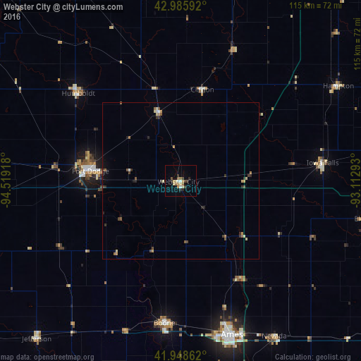
Analysis of Webster City night lights 2016
Square area 10x10 km:
 1.27%
1.27%90-99
1.11%80-89
2.06%70-79
1.9%60-69
1.9%50-59
1.75%40-49
0.95%30-39
2.7%20-29
2.22%10-19
1.11%0-9
83.02%Square area 50x50 km:
0.1%90-99
0.08%80-89
0.28%70-79
0.26%60-69
0.25%50-59
0.28%40-49
0.24%30-39
0.35%20-29
0.36%10-19
0.25%0-9
97.54%Clear (daylight) street map image can be seen on geolist.org.
Map coordinates:
42° 59' 9.3" North, 94° 31' 9" West
42° 28' 9.9" North, 93° 48' 57.8" West
41° 56' 55" North, 93° 6' 46.5" West
Some cities around Webster City sort by population:
• Ames
51 km =31.7 mi,  161°
161°
• Fort Dodge
29 km =18 mi,  276°
276°
• Boone
45.9 km =28.5 mi,  186°
186°
• Perry
74.1 km =46 mi,  198°
198°
• Nevada
58 km =36 mi,  148°
148°
• Centerville
43 km =26.7 mi, 193°
• Algona
74.9 km =46.5 mi,  332°
332°
• Iowa Falls
46.7 km =29 mi,  82°
82°
4881096 (p: 7,814)
Sources (retrieved 2019-11-25):
» Earth at Night: Flat Maps 2012, 2016