Ames night lights from space
Night Light of Ames (Iowa) from space (United States) Src. Average luminocity for 10x10km area is 58.8841% and for 50x50km: 5.8619%.

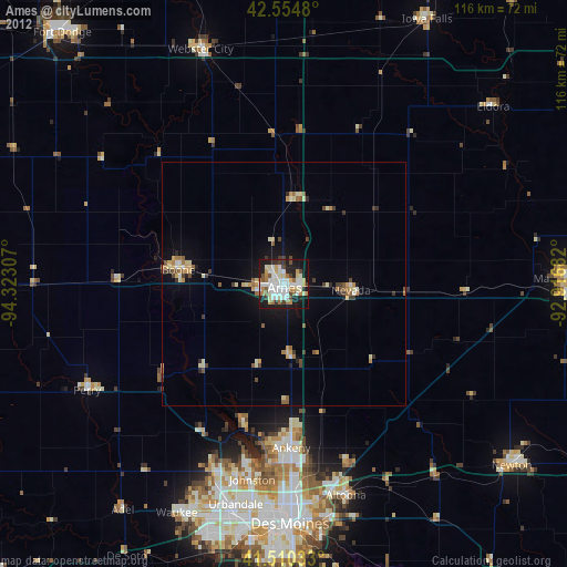
Analysis of Ames night lights 2016
Square area 10x10 km:
 16.51%
90-99
16.51%80-89
6.83%70-79
4.44%60-69
5.71%50-59
4.92%40-49
5.4%30-39
4.92%20-29
18.25%10-19
15.4%0-9
1.11%Square area 50x50 km:
0.87%90-99
0.93%80-89
0.69%70-79
0.4%60-69
0.93%50-59
0.61%40-49
0.8%30-39
0.62%20-29
1.58%10-19
3.79%0-9
88.79%Clear (daylight) street map image can be seen on geolist.org.
Map coordinates:
42° 33' 17.3" North, 94° 19' 23.1" West
42° 2' 5" North, 93° 37' 11.8" West
41° 30' 37.2" North, 92° 55' 0.6" West
Some cities around Ames sort by population:
• Ankeny
33.9 km =21.1 mi,  178°
178°
• Johnston
40.7 km =25.3 mi,  189°
189°
• Altoona
45.3 km =28.1 mi,  163°
163°
• Boone
21.7 km =13.5 mi,  277°
277°
• Grimes
41 km =25.5 mi,  200°
200°
• Perry
45.8 km =28.5 mi,  241°
241°
• Nevada
13.9 km =8.6 mi,  95°
95°
• Centerville
26.8 km =16.7 mi, 283°
4846834 (p: 65,060)
Sources (retrieved 2019-11-25):
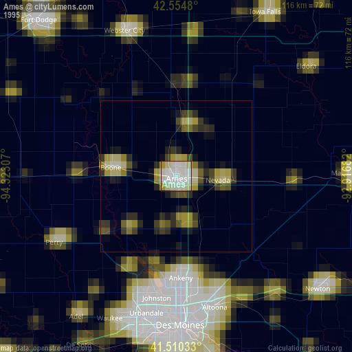
» NASA, Earths city lights 1995
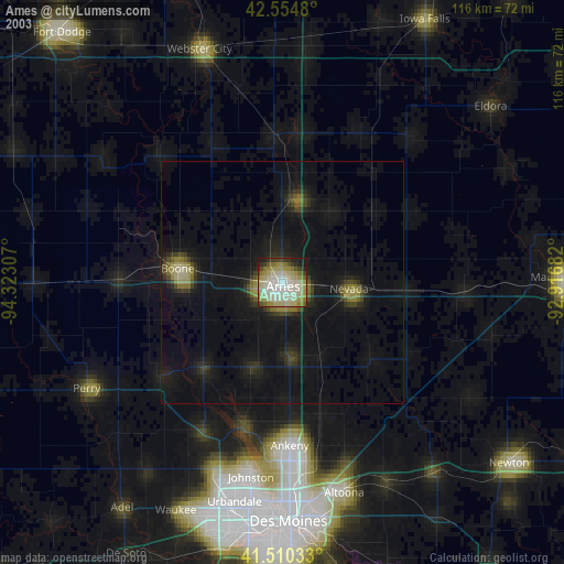
» NASA city lights 2003
» Earth at Night: Flat Maps 2012, 2016