Immokalee night lights from space
Night Light of Immokalee (Florida) from space (United States) Src. Average luminocity for 10x10km area is 28.0966% and for 50x50km: 9.1726%.
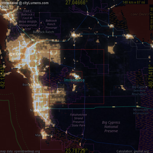
Analysis of Immokalee night lights 2016
Square area 10x10 km:
 3.22%
3.22%90-99
5.11%80-89
0.95%70-79
3.03%60-69
7.2%50-59
6.06%40-49
2.65%30-39
2.84%20-29
0.95%10-19
36.93%0-9
31.06%Square area 50x50 km:
0.26%90-99
0.44%80-89
0.28%70-79
0.49%60-69
2.87%50-59
3.5%40-49
3.04%30-39
2.86%20-29
1.48%10-19
5.17%0-9
79.61%Clear (daylight) street map image can be seen on geolist.org.
Map coordinates:
27° 2' 48" North, 82° 7' 13.5" West
26° 25' 7.3" North, 81° 25' 2.3" West
25° 47' 14.2" North, 80° 42' 51" West
Some cities around Immokalee sort by population:
• Lehigh Acres
30.9 km =19.2 mi,  318°
318°
• Bonita Springs
37.1 km =23.1 mi,  256°
256°
• Estero
38.8 km =24.1 mi,  273°
273°
• Golden Gate
37.8 km =23.5 mi,  227°
227°
• San Carlos Park
38.6 km =24 mi,  278°
278°
• Gateway
37.6 km =23.4 mi,  298°
298°
• Pelican Bay
44 km =27.3 mi,  241°
241°
• Naples Park
42.8 km =26.6 mi,  245°
245°
4159553 (p: 24,154)
Sources (retrieved 2019-11-25):
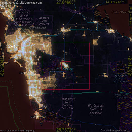
» Earth at Night: Flat Maps 2012, 2016