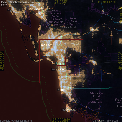
Estero night lights from space
Night Light of Estero (Florida) from space (United States) Src. Average luminocity for 10x10km area is 68.5795% and for 50x50km: 41.9842%.
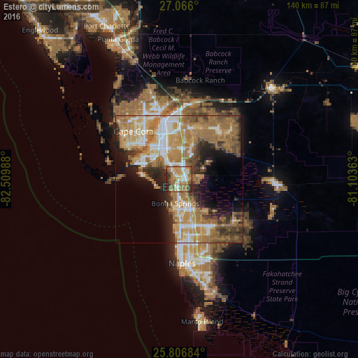
Analysis of Estero night lights 2016
Square area 10x10 km:
 8.9%
8.9%90-99
14.77%80-89
5.87%70-79
16.48%60-69
25.38%50-59
9.47%40-49
7.95%30-39
6.06%20-29
5.11%10-19
0%0-9
0%Square area 50x50 km:
5.49%90-99
6.77%80-89
4.58%70-79
8%60-69
14.03%50-59
7.32%40-49
5.42%30-39
4.38%20-29
6.27%10-19
8.21%0-9
29.53%Clear (daylight) street map image can be seen on geolist.org.
Map coordinates:
27° 3' 57.6" North, 82° 30' 35.6" West
26° 26' 17.3" North, 81° 48' 24.3" West
25° 48' 24.6" North, 81° 6' 13.1" West
Some cities around Estero sort by population:
• Bonita Springs
11.3 km =7 mi,  165°
165°
• San Carlos Park
3.3 km =2.1 mi,  9°
9°
• Iona
18.1 km =11.2 mi,  300°
300°
• Cypress Lake
14.4 km =8.9 mi,  320°
320°
• Villas
13.9 km =8.6 mi,  333°
333°
• Gateway
16.5 km =10.3 mi,  19°
19°
• McGregor
17.4 km =10.8 mi, 321°
• Fort Myers Beach
14.4 km =8.9 mi,  276°
276°
4154568 (p: 30,799)
Sources (retrieved 2019-11-25):
» Earth at Night: Flat Maps 2012, 2016