Lehigh Acres night lights from space
Night Light of Lehigh Acres (Florida) from space (United States) Src. Average luminocity for 10x10km area is 59.4886% and for 50x50km: 26.4917%.
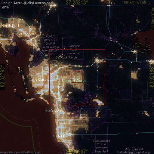
Analysis of Lehigh Acres night lights 2016
Square area 10x10 km:
 2.84%
2.84%90-99
4.73%80-89
4.36%70-79
3.79%60-69
26.89%50-59
34.85%40-49
15.72%30-39
4.92%20-29
1.89%10-19
0%0-9
0%Square area 50x50 km:
3%90-99
3.54%80-89
1.64%70-79
3.44%60-69
9.42%50-59
6.67%40-49
5.14%30-39
3.55%20-29
3.97%10-19
7.88%0-9
51.75%Clear (daylight) street map image can be seen on geolist.org.
Map coordinates:
27° 15' 7.8" North, 82° 19' 40.5" West
26° 37' 31.3" North, 81° 37' 29.3" West
25° 59' 42.3" North, 80° 55' 18" West
Some cities around Lehigh Acres sort by population:
• Fort Myers
21.5 km =13.4 mi,  268°
268°
• North Fort Myers
25.8 km =16 mi,  280°
280°
• Estero
27.6 km =17.1 mi,  221°
221°
• San Carlos Park
24.9 km =15.5 mi, 224°
• Cypress Lake
29 km =18 mi,  250°
250°
• Villas
25.6 km =15.9 mi, 251°
• Gateway
13.6 km =8.5 mi, 246°
• Fort Myers Shores
15.2 km =9.4 mi,  307°
307°
4161785 (p: 86,784)
Sources (retrieved 2019-11-25):
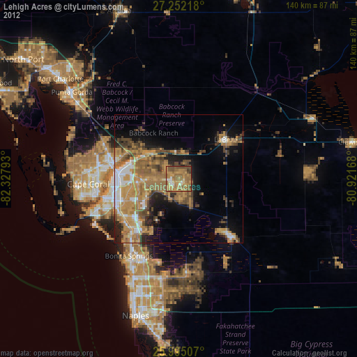
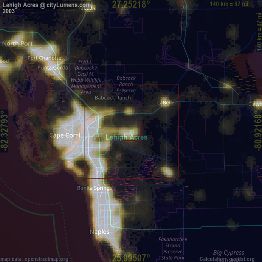
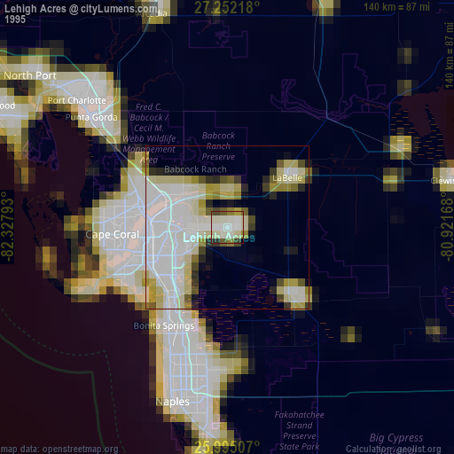
» NASA, Earths city lights 1995
» NASA city lights 2003
» Earth at Night: Flat Maps 2012, 2016