Bonita Springs night lights from space
Night Light of Bonita Springs (Florida) from space (United States) Src. Average luminocity for 10x10km area is 75.6913% and for 50x50km: 33.3639%.
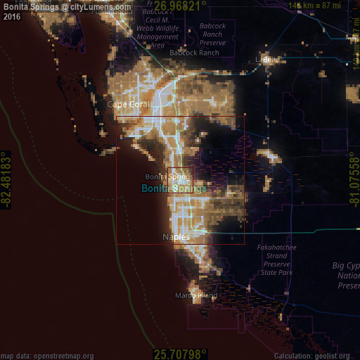
Analysis of Bonita Springs night lights 2016
Square area 10x10 km:
 13.26%
90-99
17.05%80-89
10.98%70-79
17.99%60-69
27.84%50-59
5.49%40-49
3.03%30-39
1.52%20-29
2.84%10-19
0%0-9
0%Square area 50x50 km:
4.33%90-99
5.75%80-89
3.29%70-79
5.93%60-69
9.76%50-59
4.72%40-49
5.04%30-39
4.52%20-29
7.09%10-19
9.53%0-9
40.04%Clear (daylight) street map image can be seen on geolist.org.
Map coordinates:
26° 58' 5.6" North, 82° 28' 54.6" West
26° 20' 23.3" North, 81° 46' 43.3" West
25° 42' 28.7" North, 81° 4' 32.1" West
Some cities around Bonita Springs sort by population:
• Estero
11.3 km =7 mi,  345°
345°
• Golden Gate
18.8 km =11.7 mi,  153°
153°
• East Naples
22.4 km =13.9 mi,  176°
176°
• Naples
22 km =13.7 mi, 184°
• San Carlos Park
14.4 km =8.9 mi, 350°
• Fort Myers Beach
21.2 km =13.2 mi,  306°
306°
• Pelican Bay
12.4 km =7.7 mi,  192°
192°
• Naples Park
9.2 km =5.7 mi,  199°
199°
4148533 (p: 51,704)
Sources (retrieved 2019-11-25):
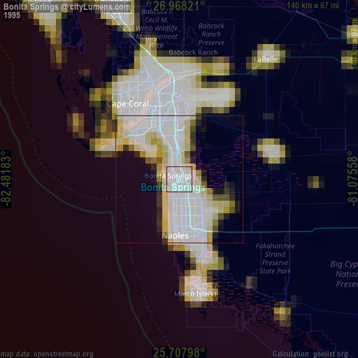
» NASA, Earths city lights 1995
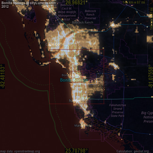
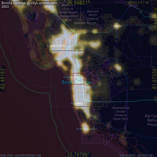
» NASA city lights 2003
» Earth at Night: Flat Maps 2012, 2016