Hutchins night lights from space
Night Light of Hutchins (Texas) from space (United States) Src. Average luminocity for 10x10km area is 75.0385% and for 50x50km: 61.7324%.
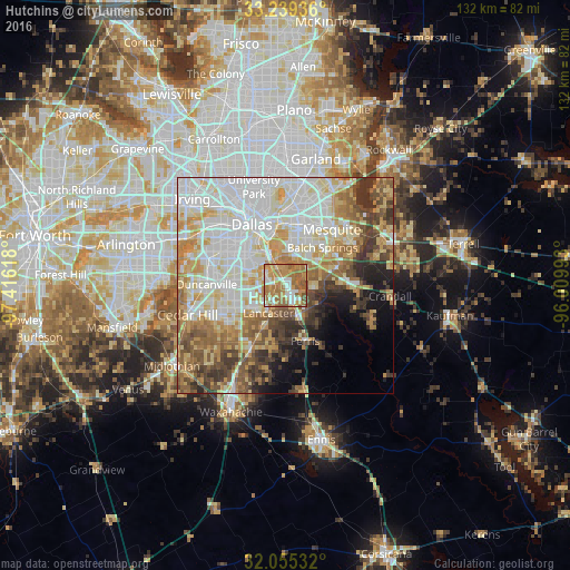
Analysis of Hutchins night lights 2016
Square area 10x10 km:
 12.41%
90-99
13.99%80-89
5.42%70-79
21.15%60-69
32.87%50-59
12.24%40-49
1.92%30-39
0%20-29
0%10-19
0%0-9
0%Square area 50x50 km:
17.34%90-99
15.36%80-89
8.67%70-79
8.75%60-69
8.23%50-59
6.94%40-49
5.83%30-39
5.92%20-29
3.6%10-19
4.9%0-9
14.44%Clear (daylight) street map image can be seen on geolist.org.
Map coordinates:
33° 14' 21.7" North, 97° 24' 58.2" West
32° 38' 57.5" North, 96° 42' 47" West
32° 3' 19.2" North, 96° 0' 35.7" West
Some cities around Hutchins sort by population:
• Dallas
17.3 km =10.7 mi,  329°
329°
• Mesquite
16.9 km =10.5 mi,  39°
39°
• DeSoto
15 km =9.3 mi,  243°
243°
• Lancaster
7.5 km =4.7 mi,  212°
212°
• Balch Springs
12.2 km =7.6 mi, 43°
• Seagoville
16.4 km =10.2 mi,  93°
93°
• Glenn Heights
17.5 km =10.9 mi,  230°
230°
• Red Oak
17 km =10.6 mi, 210°
4699608 (p: 5,727)
Sources (retrieved 2019-11-25):
» Earth at Night: Flat Maps 2012, 2016