DeSoto night lights from space
Night Light of DeSoto (Texas) from space (United States) Src. Average luminocity for 10x10km area is 86.1486% and for 50x50km: 63.5174%.
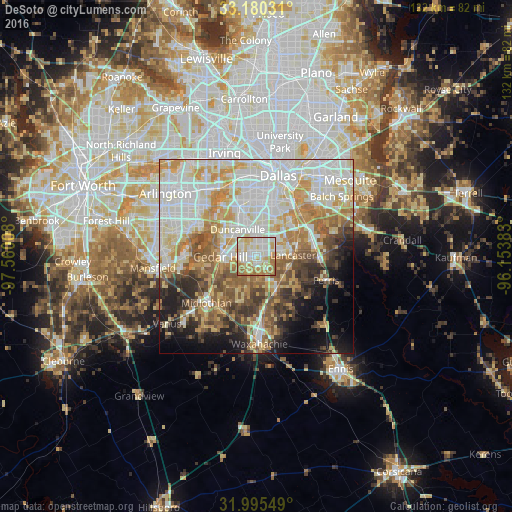
Analysis of DeSoto night lights 2016
Square area 10x10 km:
 21.85%
90-99
29.55%80-89
17.66%70-79
11.54%60-69
16.26%50-59
3.15%40-49
0%30-39
0%20-29
0%10-19
0%0-9
0%Square area 50x50 km:
17.59%90-99
15.72%80-89
9.18%70-79
9.47%60-69
7.52%50-59
7.57%40-49
5.48%30-39
5.19%20-29
4.98%10-19
7.03%0-9
10.27%Clear (daylight) street map image can be seen on geolist.org.
Map coordinates:
33° 10' 49.1" North, 97° 33' 36.3" West
32° 35' 23.5" North, 96° 51' 25" West
31° 59' 43.8" North, 96° 9' 13.8" West
Some cities around DeSoto sort by population:
• Grand Prairie
21.8 km =13.5 mi,  322°
322°
• Cedar Hill
9.3 km =5.8 mi,  269°
269°
• Duncanville
8.4 km =5.2 mi,  325°
325°
• Lancaster
9.5 km =5.9 mi,  88°
88°
• Midlothian
17.6 km =10.9 mi,  227°
227°
• Glenn Heights
4.6 km =2.9 mi,  179°
179°
• Red Oak
9.4 km =5.8 mi,  148°
148°
• Hutchins
15 km =9.3 mi,  63°
63°
4685524 (p: 52,486)
Sources (retrieved 2019-11-25):
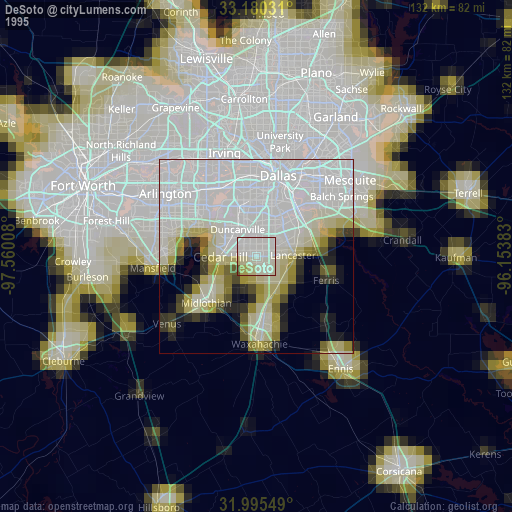
» NASA, Earths city lights 1995
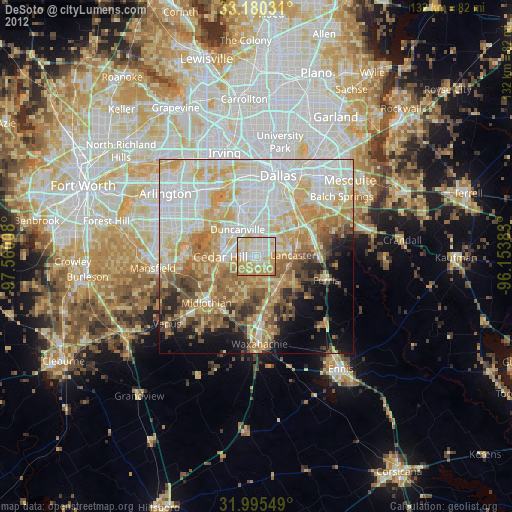
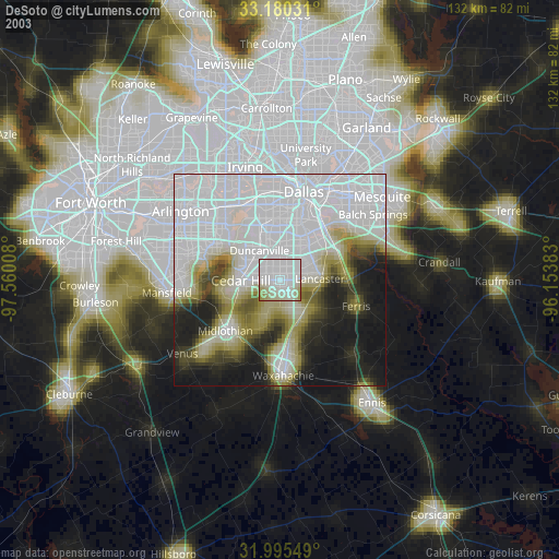
» NASA city lights 2003
» Earth at Night: Flat Maps 2012, 2016