Huntsville night lights from space
Night Light of Huntsville (Texas) from space (United States) Src. Average luminocity for 10x10km area is 51.3811% and for 50x50km: 5.8419%.
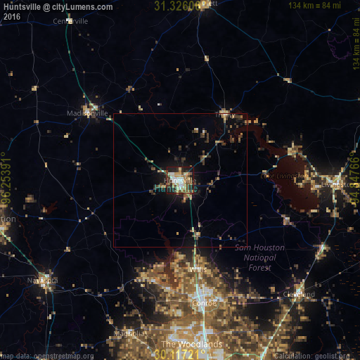
Analysis of Huntsville night lights 2016
Square area 10x10 km:
 6.29%
6.29%90-99
8.74%80-89
10.49%70-79
7.17%60-69
7.17%50-59
7.87%40-49
8.04%30-39
8.92%20-29
14.34%10-19
20.45%0-9
0.52%Square area 50x50 km:
0.32%90-99
0.45%80-89
0.88%70-79
0.48%60-69
0.74%50-59
0.96%40-49
1.07%30-39
1.95%20-29
1.66%10-19
3.85%0-9
87.64%Clear (daylight) street map image can be seen on geolist.org.
Map coordinates:
31° 19' 33.8" North, 96° 15' 14.1" West
30° 43' 24.7" North, 95° 33' 2.8" West
30° 7' 2" North, 94° 50' 51.6" West
Some cities around Huntsville sort by population:
• The Woodlands
63.2 km =39.3 mi,  174°
174°
• Conroe
46.7 km =29 mi, 168°
• West Livingston
52.5 km =32.6 mi,  93°
93°
• Cleveland
61.6 km =38.3 mi,  133°
133°
• Navasota
63.5 km =39.5 mi,  234°
234°
• Crockett
66.7 km =41.4 mi,  7°
7°
• Willis
33.9 km =21.1 mi, 168°
• Livingston
59.1 km =36.7 mi, 91°
4699540 (p: 40,938)
Sources (retrieved 2019-11-25):
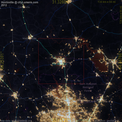
» Earth at Night: Flat Maps 2012, 2016