Huntington Woods night lights from space
Night Light of Huntington Woods (Michigan) from space (United States) Src. Average luminocity for 10x10km area is 97.681% and for 50x50km: 85.6753%.
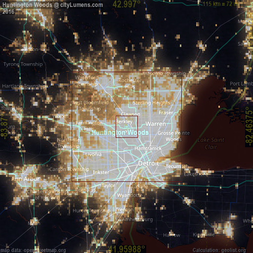
Analysis of Huntington Woods night lights 2016
Square area 10x10 km:
 54.92%
90-99
36.51%80-89
8.1%70-79
0.48%60-69
0%50-59
0%40-49
0%30-39
0%20-29
0%10-19
0%0-9
0%Square area 50x50 km:
36.62%90-99
23.57%80-89
8.58%70-79
9.7%60-69
10.25%50-59
5.75%40-49
2.43%30-39
1.34%20-29
1.44%10-19
0.33%0-9
0%Clear (daylight) street map image can be seen on geolist.org.
Map coordinates:
42° 59' 49.2" North, 83° 52' 12" West
42° 28' 50.1" North, 83° 10' 0.7" West
41° 57' 35.6" North, 82° 27' 49.5" West
Some cities around Huntington Woods sort by population:
• Southfield
4.6 km =2.9 mi,  259°
259°
• Royal Oak
2.1 km =1.3 mi,  61°
61°
• Madison Heights
5.1 km =3.2 mi,  83°
83°
• Oak Park
2.7 km =1.7 mi,  208°
208°
• Ferndale
3.5 km =2.2 mi,  130°
130°
• Hazel Park
5.5 km =3.4 mi,  111°
111°
• Berkley
2.9 km =1.8 mi,  331°
331°
• Clawson
6.1 km =3.8 mi,  16°
16°
4996832 (p: 6,340)
Sources (retrieved 2019-11-25):
» Earth at Night: Flat Maps 2012, 2016