Clawson night lights from space
Night Light of Clawson (Michigan) from space (United States) Src. Average luminocity for 10x10km area is 95.6984% and for 50x50km: 79.066%.
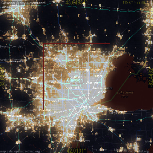
Analysis of Clawson night lights 2016
Square area 10x10 km:
 42.38%
90-99
39.84%80-89
11.9%70-79
5.08%60-69
0.79%50-59
0%40-49
0%30-39
0%20-29
0%10-19
0%0-9
0%Square area 50x50 km:
31.78%90-99
19.97%80-89
7.89%70-79
9.19%60-69
10.27%50-59
7.03%40-49
3.83%30-39
2.73%20-29
3.62%10-19
2.57%0-9
1.12%Clear (daylight) street map image can be seen on geolist.org.
Map coordinates:
43° 2' 57.6" North, 83° 50' 58" West
42° 32' 0.1" North, 83° 8' 46.8" West
42° 0' 47.2" North, 82° 26' 35.5" West
Some cities around Clawson sort by population:
• Troy
8 km =5 mi,  357°
357°
• Royal Oak
4.9 km =3 mi,  178°
178°
• Madison Heights
6.3 km =3.9 mi,  147°
147°
• Birmingham
5.5 km =3.4 mi,  285°
285°
• Ferndale
8.1 km =5 mi,  173°
173°
• Berkley
4.5 km =2.8 mi,  222°
222°
• Beverly Hills
6.4 km =4 mi,  260°
260°
• Huntington Woods
6.1 km =3.8 mi,  196°
196°
4989005 (p: 12,015)
Sources (retrieved 2019-11-25):
» Earth at Night: Flat Maps 2012, 2016