Lake Norman of Catawba night lights from space
Night Light of Lake Norman of Catawba (North Carolina) from space (United States) Src. Average luminocity for 10x10km area is 39.4476% and for 50x50km: 35.6789%.
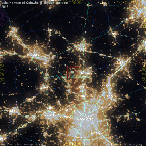
Analysis of Lake Norman of Catawba night lights 2016
Square area 10x10 km:
 0.35%
0.35%90-99
1.05%80-89
4.02%70-79
4.2%60-69
11.71%50-59
10.49%40-49
9.62%30-39
16.78%20-29
26.92%10-19
13.11%0-9
1.75%Square area 50x50 km:
3.08%90-99
3.55%80-89
5.82%70-79
5.63%60-69
6.98%50-59
6.17%40-49
5.85%30-39
9.89%20-29
12.2%10-19
15.99%0-9
24.85%Clear (daylight) street map image can be seen on geolist.org.
Map coordinates:
36° 9' 23.6" North, 81° 39' 45.5" West
35° 35' 12.5" North, 80° 57' 34.3" West
35° 0' 46.7" North, 80° 15' 23" West
Some cities around Lake Norman of Catawba sort by population:
• Huntersville
22.2 km =13.8 mi,  151°
151°
• Mooresville
13.5 km =8.4 mi,  90°
90°
• Cornelius
14.3 km =8.9 mi,  141°
141°
• Statesville
22.7 km =14.1 mi,  16°
16°
• Newton
25.4 km =15.8 mi,  291°
291°
• Davidson
14.4 km =8.9 mi,  130°
130°
• Lincolnton
29.5 km =18.3 mi,  244°
244°
• Conover
26.9 km =16.7 mi,  299°
299°
4474841 (p: 5,075)
Sources (retrieved 2019-11-25):
» Earth at Night: Flat Maps 2012, 2016