Hollymead night lights from space
Night Light of Hollymead (Virginia) from space (United States) Src. Average luminocity for 10x10km area is 25.4367% and for 50x50km: 5.3949%.
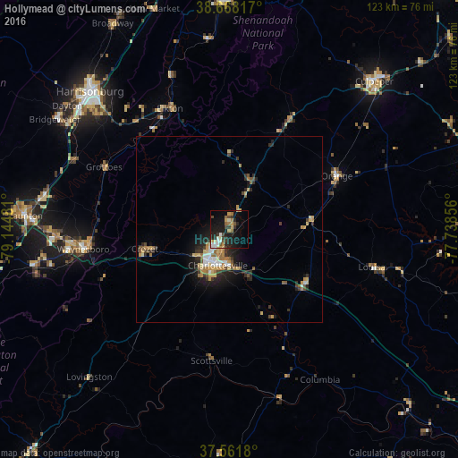
Analysis of Hollymead night lights 2016
Square area 10x10 km:
 2.44%
2.44%90-99
4.06%80-89
2.76%70-79
4.22%60-69
3.08%50-59
1.79%40-49
4.06%30-39
4.55%20-29
8.12%10-19
23.38%0-9
41.56%Square area 50x50 km:
0.57%90-99
0.61%80-89
0.74%70-79
0.99%60-69
0.68%50-59
0.66%40-49
0.62%30-39
0.9%20-29
1.67%10-19
3.39%0-9
89.18%Clear (daylight) street map image can be seen on geolist.org.
Map coordinates:
38° 40' 5.4" North, 79° 8' 41.3" West
38° 7' 1.5" North, 78° 26' 30" West
37° 33' 42.5" North, 77° 44' 18.8" West
Some cities around Hollymead sort by population:
• Harrisonburg
52.5 km =32.6 mi,  314°
314°
• Charlottesville
10.2 km =6.3 mi,  197°
197°
• Waynesboro
39.6 km =24.6 mi,  262°
262°
• Lake Monticello
23.5 km =14.6 mi,  156°
156°
• Stuarts Draft
52.7 km =32.7 mi, 259°
• Fishersville
46.2 km =28.7 mi,  267°
267°
• Bridgewater
55.2 km =34.3 mi,  302°
302°
• Crozet
23.3 km =14.5 mi, 256°
4764607 (p: 7,690)
Sources (retrieved 2019-11-25):
» Earth at Night: Flat Maps 2012, 2016