Stuarts Draft night lights from space
Night Light of Stuarts Draft (Virginia) from space (United States) Src. Average luminocity for 10x10km area is 17.5244% and for 50x50km: 5.424%.
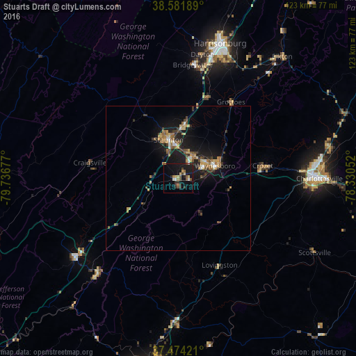
Analysis of Stuarts Draft night lights 2016
Square area 10x10 km:
 1.14%
1.14%90-99
1.14%80-89
2.6%70-79
1.95%60-69
1.95%50-59
3.08%40-49
2.92%30-39
3.57%20-29
2.92%10-19
23.21%0-9
55.52%Square area 50x50 km:
0.32%90-99
0.38%80-89
0.78%70-79
0.82%60-69
0.83%50-59
1.07%40-49
0.65%30-39
1.03%20-29
1.13%10-19
6.27%0-9
86.73%Clear (daylight) street map image can be seen on geolist.org.
Map coordinates:
38° 34' 54.8" North, 79° 44' 12.4" West
38° 1' 48.5" North, 79° 2' 1.1" West
37° 28' 27.2" North, 78° 19' 49.9" West
Some cities around Stuarts Draft sort by population:
• Harrisonburg
48.8 km =30.3 mi,  17°
17°
• Staunton
13.8 km =8.6 mi,  345°
345°
• Waynesboro
13.3 km =8.3 mi,  71°
71°
• Fishersville
9.5 km =5.9 mi,  36°
36°
• Lexington
45.1 km =28 mi,  232°
232°
• Buena Vista
43.3 km =26.9 mi,  220°
220°
• Bridgewater
39.4 km =24.5 mi,  7°
7°
• Crozet
29.5 km =18.3 mi,  81°
81°
4788070 (p: 9,235)
Sources (retrieved 2019-11-25):
» Earth at Night: Flat Maps 2012, 2016