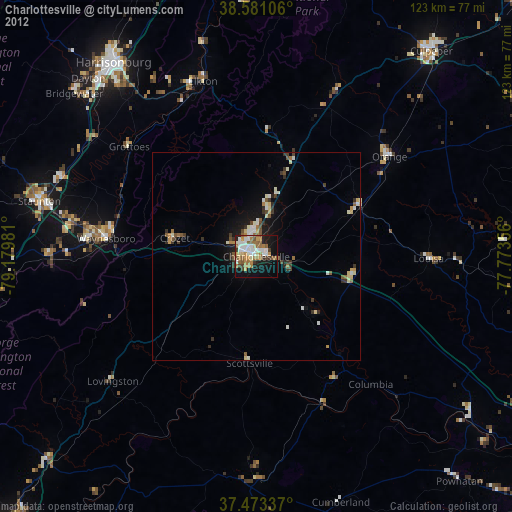
Charlottesville night lights from space
Night Light of Charlottesville (Virginia) from space (United States) Src. Average luminocity for 10x10km area is 53.9903% and for 50x50km: 5.3498%.
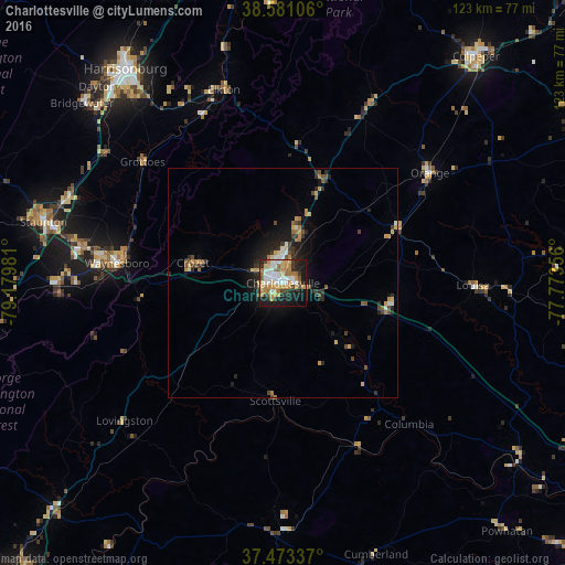
Analysis of Charlottesville night lights 2016
Square area 10x10 km:
 10.88%
90-99
9.25%80-89
8.93%70-79
10.55%60-69
9.25%50-59
5.68%40-49
2.76%30-39
6.17%20-29
11.69%10-19
21.59%0-9
3.25%Square area 50x50 km:
0.57%90-99
0.61%80-89
0.72%70-79
0.97%60-69
0.69%50-59
0.66%40-49
0.68%30-39
0.85%20-29
1.68%10-19
3.38%0-9
89.18%Clear (daylight) street map image can be seen on geolist.org.
Map coordinates:
38° 34' 51.8" North, 79° 10' 47.3" West
38° 1' 45.5" North, 78° 28' 36" West
37° 28' 24.1" North, 77° 46' 24.8" West
Some cities around Charlottesville sort by population:
• Harrisonburg
57.9 km =36 mi,  323°
323°
• Staunton
53.9 km =33.5 mi,  284°
284°
• Waynesboro
36.4 km =22.6 mi, 276°
• Lake Monticello
17.1 km =10.6 mi,  133°
133°
• Stuarts Draft
48.8 km =30.3 mi,  270°
270°
• Hollymead
10.2 km =6.3 mi,  17°
17°
• Fishersville
43.8 km =27.2 mi, 280°
• Crozet
20.1 km =12.5 mi, 282°
4752031 (p: 46,597)
Sources (retrieved 2019-11-25):
» Earth at Night: Flat Maps 2012, 2016