Hollins night lights from space
Night Light of Hollins (Virginia) from space (United States) Src. Average luminocity for 10x10km area is 66.0779% and for 50x50km: 13.3277%.
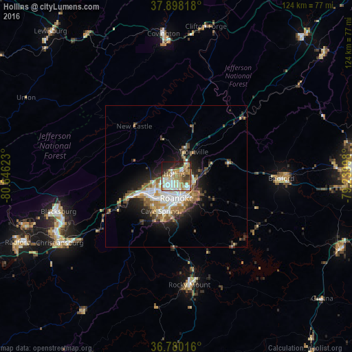
Analysis of Hollins night lights 2016
Square area 10x10 km:
 13.64%
90-99
17.53%80-89
7.63%70-79
10.23%60-69
15.1%50-59
6.01%40-49
6.17%30-39
5.03%20-29
12.01%10-19
6.33%0-9
0.32%Square area 50x50 km:
2.37%90-99
2.69%80-89
1.44%70-79
1.55%60-69
2.01%50-59
1.93%40-49
1.56%30-39
1.78%20-29
3.27%10-19
6.27%0-9
75.14%Clear (daylight) street map image can be seen on geolist.org.
Map coordinates:
37° 53' 53.4" North, 80° 38' 46.4" West
37° 20' 28.5" North, 79° 56' 35.2" West
36° 46' 48.6" North, 79° 14' 23.9" West
Some cities around Hollins sort by population:
• Roanoke
7.8 km =4.8 mi,  178°
178°
• Blacksburg
43.5 km =27 mi,  253°
253°
• Salem
11.2 km =7 mi,  241°
241°
• Cave Spring
14.1 km =8.8 mi,  206°
206°
• Christiansburg
47.5 km =29.5 mi, 240°
• Vinton
7.8 km =4.8 mi,  148°
148°
• Bedford
37.1 km =23.1 mi,  91°
91°
• Covington
50.5 km =31.4 mi,  354°
354°
4764534 (p: 14,673)
Sources (retrieved 2019-11-25):
» Earth at Night: Flat Maps 2012, 2016