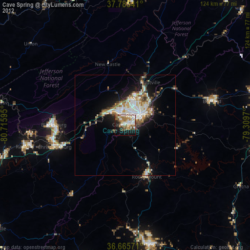
Cave Spring night lights from space
Night Light of Cave Spring (Virginia) from space (United States) Src. Average luminocity for 10x10km area is 55.6837% and for 50x50km: 13.6887%.

Analysis of Cave Spring night lights 2016
Square area 10x10 km:
 7.99%
7.99%90-99
13.95%80-89
9.52%70-79
7.14%60-69
9.86%50-59
10.54%40-49
4.08%30-39
4.59%20-29
11.05%10-19
17.01%0-9
4.25%Square area 50x50 km:
2.42%90-99
2.74%80-89
1.63%70-79
1.57%60-69
2%50-59
1.86%40-49
1.53%30-39
1.65%20-29
3.37%10-19
7%0-9
74.24%Clear (daylight) street map image can be seen on geolist.org.
Map coordinates:
37° 47' 7.5" North, 80° 42' 57.4" West
37° 13' 39.5" North, 80° 0' 46.2" West
36° 39' 56.6" North, 79° 18' 34.9" West
Some cities around Cave Spring sort by population:
• Roanoke
7.9 km =4.9 mi,  52°
52°
• Blacksburg
35.5 km =22.1 mi,  270°
270°
• Salem
8.2 km =5.1 mi,  333°
333°
• Christiansburg
36.7 km =22.8 mi,  252°
252°
• Radford
51.1 km =31.8 mi,  257°
257°
• Hollins
14.1 km =8.8 mi,  26°
26°
• Vinton
11.8 km =7.3 mi,  59°
59°
• Bedford
44.9 km =27.9 mi,  74°
74°
4751421 (p: 24,922)
Sources (retrieved 2019-11-25):
» Earth at Night: Flat Maps 2012, 2016