Bedford night lights from space
Night Light of Bedford (Virginia) from space (United States) Src. Average luminocity for 10x10km area is 22.638% and for 50x50km: 4.8393%.
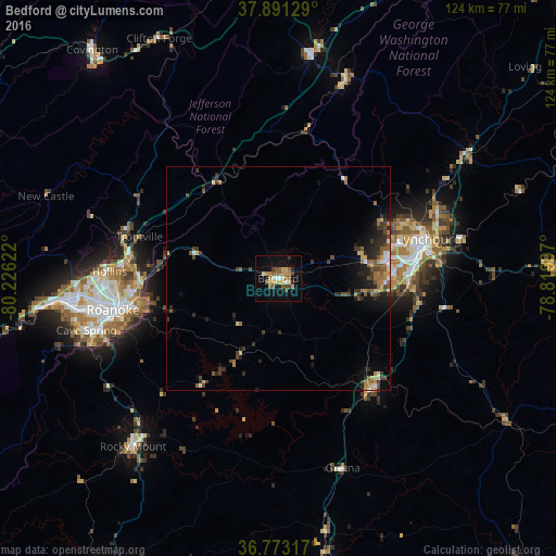
Analysis of Bedford night lights 2016
Square area 10x10 km:
 0.81%
0.81%90-99
1.95%80-89
4.87%70-79
3.57%60-69
4.06%50-59
5.68%40-49
2.92%30-39
1.95%20-29
0.97%10-19
15.58%0-9
57.63%Square area 50x50 km:
0.27%90-99
0.35%80-89
0.69%70-79
0.48%60-69
0.94%50-59
0.98%40-49
0.86%30-39
1.18%20-29
1.46%10-19
2.78%0-9
90.01%Clear (daylight) street map image can be seen on geolist.org.
Map coordinates:
37° 53' 28.6" North, 80° 13' 34.4" West
37° 20' 3.5" North, 79° 31' 23.1" West
36° 46' 23.4" North, 78° 49' 11.9" West
Some cities around Bedford sort by population:
• Roanoke
37.7 km =23.4 mi,  259°
259°
• Lynchburg
34.8 km =21.6 mi,  75°
75°
• West Lynchburg
31.4 km =19.5 mi, 75°
• Hollins
37.1 km =23.1 mi,  271°
271°
• Timberlake
23.5 km =14.6 mi,  93°
93°
• Madison Heights
36.9 km =22.9 mi,  73°
73°
• Forest
20.9 km =13 mi, 80°
• Vinton
33.6 km =20.9 mi, 259°
4746265 (p: 6,561)
Sources (retrieved 2019-11-25):
» Earth at Night: Flat Maps 2012, 2016