Hillsdale night lights from space
Night Light of Hillsdale (Michigan) from space (United States) Src. Average luminocity for 10x10km area is 14.5698% and for 50x50km: 1.7382%.
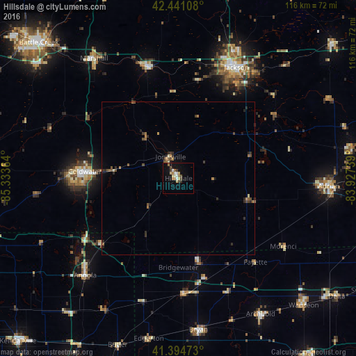
Analysis of Hillsdale night lights 2016
Square area 10x10 km:
 1.9%
1.9%90-99
1.9%80-89
2.7%70-79
0.48%60-69
3.17%50-59
0.79%40-49
2.54%30-39
1.59%20-29
0.16%10-19
10.48%0-9
74.29%Square area 50x50 km:
0.08%90-99
0.15%80-89
0.18%70-79
0.17%60-69
0.42%50-59
0.23%40-49
0.36%30-39
0.32%20-29
0.54%10-19
0.58%0-9
96.96%Clear (daylight) street map image can be seen on geolist.org.
Map coordinates:
42° 26' 27.9" North, 85° 20' 1.1" West
41° 55' 12.2" North, 84° 37' 49.8" West
41° 23' 41" North, 83° 55' 38.6" West
Some cities around Hillsdale sort by population:
• Jackson
40.9 km =25.4 mi,  27°
27°
• Adrian
49.2 km =30.6 mi,  92°
92°
• Coldwater
30.7 km =19.1 mi,  274°
274°
• Angola
44.1 km =27.4 mi,  223°
223°
• Bryan
49.9 km =31 mi,  172°
172°
• Tecumseh
57.4 km =35.7 mi,  80°
80°
• Albion
37.3 km =23.2 mi,  344°
344°
• Marshall
47.8 km =29.7 mi,  324°
324°
4996107 (p: 8,163)
Sources (retrieved 2019-11-25):
» Earth at Night: Flat Maps 2012, 2016