Albion night lights from space
Night Light of Albion (Michigan) from space (United States) Src. Average luminocity for 10x10km area is 14.3303% and for 50x50km: 3.4181%.
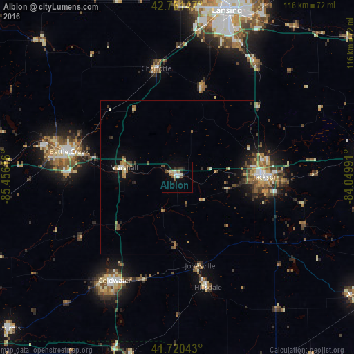
Analysis of Albion night lights 2016
Square area 10x10 km:
 1.36%
1.36%90-99
3.64%80-89
1.67%70-79
0%60-69
1.82%50-59
1.82%40-49
2.42%30-39
1.82%20-29
2.73%10-19
2.42%0-9
80.3%Square area 50x50 km:
0.11%90-99
0.5%80-89
0.31%70-79
0.38%60-69
0.57%50-59
0.48%40-49
0.76%30-39
0.6%20-29
0.94%10-19
1.9%0-9
93.44%Clear (daylight) street map image can be seen on geolist.org.
Map coordinates:
42° 45' 41.3" North, 85° 27' 22.2" West
42° 14' 35.2" North, 84° 45' 10.9" West
41° 43' 13.5" North, 84° 2' 59.7" West
Some cities around Albion sort by population:
• Battle Creek
35.9 km =22.3 mi,  283°
283°
• Jackson
28.9 km =18 mi,  89°
89°
• Coldwater
39.4 km =24.5 mi,  211°
211°
• Charlotte
36.3 km =22.6 mi,  349°
349°
• Hillsdale
37.3 km =23.2 mi,  164°
164°
• Marshall
17.6 km =10.9 mi, 280°
• Eaton Rapids
30.6 km =19 mi,  15°
15°
• Springfield
41 km =25.5 mi, 283°
4983905 (p: 8,229)
Sources (retrieved 2019-11-25):
» Earth at Night: Flat Maps 2012, 2016