Henderson night lights from space
Night Light of Henderson (Tennessee) from space (United States) Src. Average luminocity for 10x10km area is 21.2784% and for 50x50km: 7.2915%.
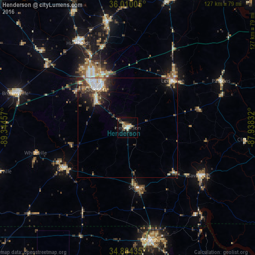
Analysis of Henderson night lights 2016
Square area 10x10 km:
 1.28%
1.28%90-99
3.85%80-89
4.76%70-79
0.73%60-69
3.11%50-59
3.66%40-49
2.56%30-39
2.93%20-29
3.66%10-19
12.09%0-9
61.36%Square area 50x50 km:
1.1%90-99
1.29%80-89
1.13%70-79
0.59%60-69
0.7%50-59
0.73%40-49
1.03%30-39
2.29%20-29
1.64%10-19
3.36%0-9
86.14%Clear (daylight) street map image can be seen on geolist.org.
Map coordinates:
36° 0' 36.2" North, 89° 20' 40.5" West
35° 26' 21.3" North, 88° 38' 29.2" West
34° 51' 51.7" North, 87° 56' 18" West
Some cities around Henderson sort by population:
• Jackson
25 km =15.5 mi,  321°
321°
• Corinth
57.2 km =35.5 mi,  169°
169°
• Humboldt
49 km =30.4 mi,  329°
329°
• Lexington
32.5 km =20.2 mi,  43°
43°
• Milan
54.5 km =33.9 mi,  348°
348°
• Savannah
42.8 km =26.6 mi,  123°
123°
• Mount Carmel
57.7 km =35.9 mi,  83°
83°
• Bolivar
37.4 km =23.2 mi,  237°
237°
4628695 (p: 6,552)
Sources (retrieved 2019-11-25):
» Earth at Night: Flat Maps 2012, 2016