Bolivar night lights from space
Night Light of Bolivar (Tennessee) from space (United States) Src. Average luminocity for 10x10km area is 27.5297% and for 50x50km: 2.7373%.
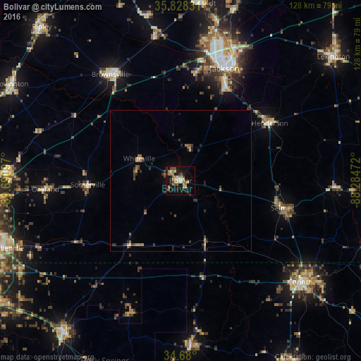
Analysis of Bolivar night lights 2016
Square area 10x10 km:
 1.22%
1.22%90-99
3.85%80-89
4.37%70-79
4.72%60-69
6.12%50-59
3.5%40-49
3.85%30-39
4.2%20-29
3.15%10-19
27.8%0-9
37.24%Square area 50x50 km:
0.06%90-99
0.2%80-89
0.32%70-79
0.42%60-69
0.53%50-59
0.47%40-49
0.41%30-39
0.83%20-29
0.66%10-19
1.45%0-9
94.65%Clear (daylight) street map image can be seen on geolist.org.
Map coordinates:
35° 49' 41.9" North, 89° 41' 27.5" West
35° 15' 22.3" North, 88° 59' 16.2" West
34° 40' 48" North, 88° 17' 5" West
Some cities around Bolivar sort by population:
• Jackson
42.8 km =26.6 mi,  21°
21°
• Corinth
55.5 km =34.5 mi,  130°
130°
• Arlington
61.3 km =38.1 mi,  274°
274°
• Brownsville
45 km =28 mi,  326°
326°
• Humboldt
63 km =39.1 mi,  5°
5°
• Oakland
48 km =29.8 mi, 266°
• Henderson
37.4 km =23.2 mi,  57°
57°
• Ripley
58.6 km =36.4 mi,  176°
176°
4607598 (p: 5,093)
Sources (retrieved 2019-11-25):
» Earth at Night: Flat Maps 2012, 2016