San Leandro night lights from space
Night Light of San Leandro (California) from space (United States) Src. Average luminocity for 10x10km area is 80.1973% and for 50x50km: 46.2673%.

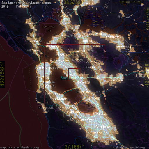
Analysis of San Leandro night lights 2016
Square area 10x10 km:
 33.33%
90-99
26.19%80-89
3.91%70-79
5.78%60-69
5.27%50-59
8.5%40-49
6.29%30-39
4.42%20-29
5.61%10-19
0.68%0-9
0%Square area 50x50 km:
11.11%90-99
9.7%80-89
2.63%70-79
4.89%60-69
6.14%50-59
7.97%40-49
7.04%30-39
6.01%20-29
12.95%10-19
18.07%0-9
13.5%Clear (daylight) street map image can be seen on geolist.org.
Map coordinates:
38° 16' 44.3" North, 122° 51' 33.2" West
37° 43' 29.7" North, 122° 9' 21.9" West
37° 10' 0.1" North, 121° 27' 10.7" West
Some cities around San Leandro sort by population:
• Hayward
9.1 km =5.7 mi,  133°
133°
• Alameda
8.8 km =5.5 mi,  300°
300°
• Castro Valley
7 km =4.3 mi,  119°
119°
• Ashland
5 km =3.1 mi, 132°
• Moraga
12.4 km =7.7 mi,  10°
10°
• Cherryland
6.9 km =4.3 mi,  137°
137°
• Piedmont
12.9 km =8 mi,  329°
329°
• Fairview
11 km =6.8 mi, 117°
5392263 (p: 90,712)
Sources (retrieved 2019-11-25):
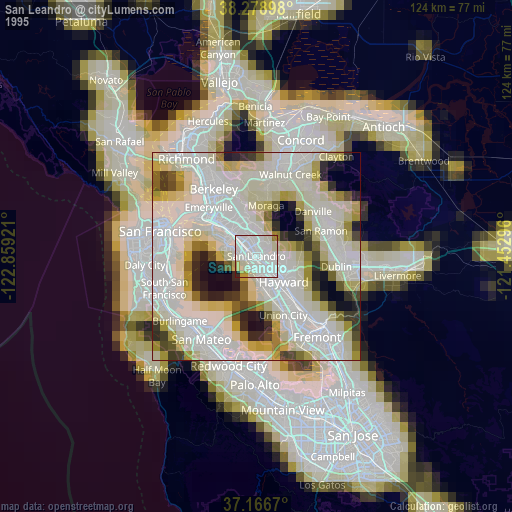
» NASA, Earths city lights 1995
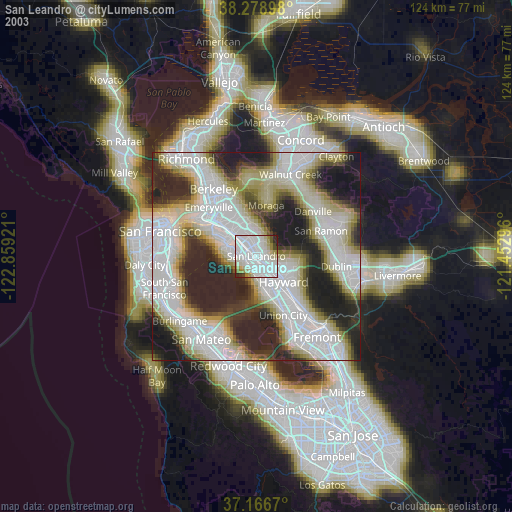
» NASA city lights 2003
» Earth at Night: Flat Maps 2012, 2016