Hartselle night lights from space
Night Light of Hartselle (Alabama) from space (United States) Src. Average luminocity for 10x10km area is 41.3357% and for 50x50km: 15.7764%.
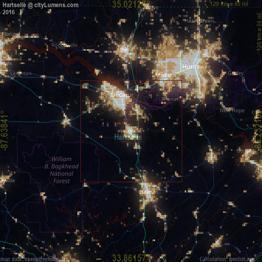
Analysis of Hartselle night lights 2016
Square area 10x10 km:
 3.85%
3.85%90-99
3.85%80-89
8.04%70-79
8.74%60-69
5.77%50-59
6.99%40-49
2.8%30-39
5.94%20-29
21.15%10-19
31.29%0-9
1.57%Square area 50x50 km:
1.57%90-99
1.77%80-89
2.29%70-79
2.28%60-69
2.14%50-59
2.07%40-49
2.37%30-39
4.02%20-29
6.14%10-19
10.86%0-9
64.49%Clear (daylight) street map image can be seen on geolist.org.
Map coordinates:
35° 1' 16.6" North, 87° 38' 18.3" West
34° 26' 36.3" North, 86° 56' 7" West
33° 51' 41.7" North, 86° 13' 55.8" West
Some cities around Hartselle sort by population:
• Huntsville
45.2 km =28.1 mi,  45°
45°
• Decatur
18.6 km =11.6 mi,  346°
346°
• Madison
33.2 km =20.6 mi,  31°
31°
• Athens
40.1 km =24.9 mi,  355°
355°
• Cullman
31 km =19.3 mi,  164°
164°
• Arab
42.7 km =26.5 mi,  109°
109°
• Danville
14.3 km =8.9 mi,  257°
257°
• Harvest
48.8 km =30.3 mi,  20°
20°
4066449 (p: 14,493)
Sources (retrieved 2019-11-25):
» Earth at Night: Flat Maps 2012, 2016