Harvest night lights from space
Night Light of Harvest (Alabama) from space (United States) Src. Average luminocity for 10x10km area is 37.6172% and for 50x50km: 32.6736%.
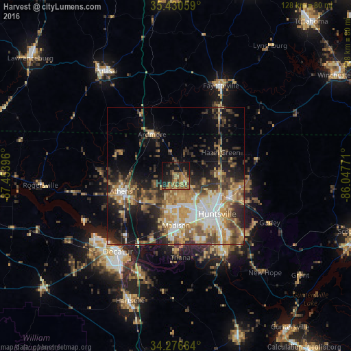
Analysis of Harvest night lights 2016
Square area 10x10 km:
 0.55%
0.55%90-99
0.18%80-89
3.11%70-79
11.54%60-69
10.62%50-59
9.52%40-49
8.79%30-39
8.61%20-29
9.16%10-19
28.94%0-9
8.97%Square area 50x50 km:
4.47%90-99
4.57%80-89
4.9%70-79
5.89%60-69
5.6%50-59
4.98%40-49
5.08%30-39
6.41%20-29
7.14%10-19
11.44%0-9
39.51%Clear (daylight) street map image can be seen on geolist.org.
Map coordinates:
35° 25' 50.1" North, 87° 27' 14.3" West
34° 51' 20.3" North, 86° 45' 3" West
34° 16' 35.9" North, 86° 2' 51.8" West
Some cities around Harvest sort by population:
• Huntsville
20.5 km =12.7 mi,  132°
132°
• Decatur
35 km =21.7 mi,  217°
217°
• Madison
17.4 km =10.8 mi,  179°
179°
• Athens
21.1 km =13.1 mi,  253°
253°
• Pulaski
46 km =28.6 mi,  326°
326°
• Fayetteville
36.8 km =22.9 mi,  26°
26°
• Meridianville
16.3 km =10.1 mi,  91°
91°
• Moores Mill
21.3 km =13.2 mi, 93°
4066463 (p: 5,281)
Sources (retrieved 2019-11-25):
» Earth at Night: Flat Maps 2012, 2016