Danville night lights from space
Night Light of Danville (Alabama) from space (United States) Src. Average luminocity for 10x10km area is 0.9738% and for 50x50km: 13.0416%.
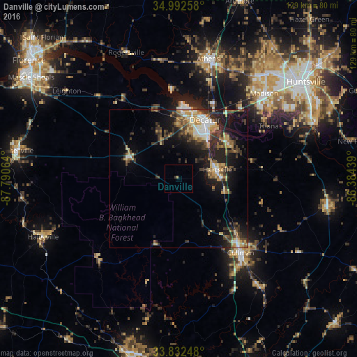
Analysis of Danville night lights 2016
Square area 10x10 km:
 0%
0%90-99
0%80-89
0%70-79
0.7%60-69
0%50-59
0%40-49
0%30-39
0.7%20-29
0%10-19
0%0-9
98.6%Square area 50x50 km:
1.33%90-99
1.42%80-89
2.2%70-79
1.82%60-69
1.77%50-59
1.64%40-49
1.9%30-39
3.47%20-29
4.39%10-19
8.18%0-9
71.89%Clear (daylight) street map image can be seen on geolist.org.
Map coordinates:
34° 59' 33.3" North, 87° 47' 26.3" West
34° 24' 52.3" North, 87° 5' 15" West
33° 49' 56.9" North, 86° 23' 3.8" West
Some cities around Danville sort by population:
• Huntsville
57.8 km =35.9 mi,  52°
52°
• Decatur
23.3 km =14.5 mi,  24°
24°
• Madison
44.3 km =27.5 mi,  44°
44°
• Athens
44.4 km =27.6 mi,  13°
13°
• Cullman
34.8 km =21.6 mi,  139°
139°
• Hartselle
14.3 km =8.9 mi,  77°
77°
• Arab
55.4 km =34.4 mi,  101°
101°
• Harvest
57.9 km =36 mi,  32°
32°
4058198 (p: 6,242)
Sources (retrieved 2019-11-25):
» Earth at Night: Flat Maps 2012, 2016