Hanover night lights from space
Night Light of Hanover (Massachusetts) from space (United States) Src. Average luminocity for 10x10km area is 35.2682% and for 50x50km: 31.0606%.
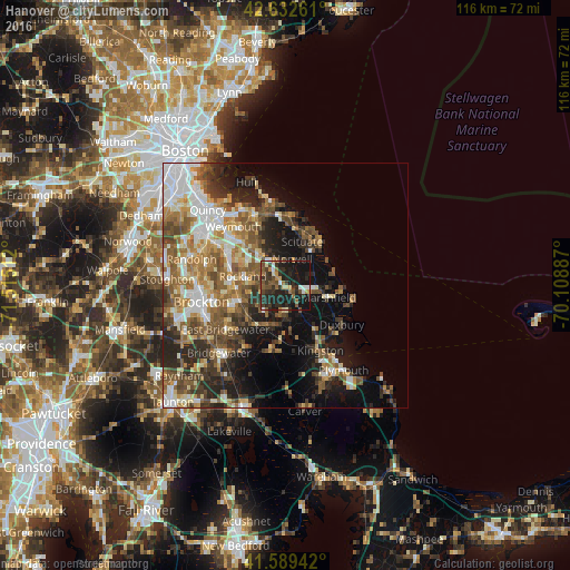
Analysis of Hanover night lights 2016
Square area 10x10 km:
 2.88%
2.88%90-99
3.79%80-89
3.18%70-79
3.48%60-69
4.55%50-59
6.36%40-49
7.42%30-39
10.91%20-29
20.15%10-19
37.27%0-9
0%Square area 50x50 km:
5.15%90-99
5.47%80-89
3.51%70-79
3.34%60-69
5.37%50-59
6.32%40-49
5.49%30-39
4.37%20-29
7.82%10-19
12.14%0-9
41.02%Clear (daylight) street map image can be seen on geolist.org.
Map coordinates:
42° 37' 57.4" North, 71° 30' 54.4" West
42° 6' 47.4" North, 70° 48' 43.2" West
41° 35' 21.9" North, 70° 6' 31.9" West
Some cities around Hanover sort by population:
• Rockland
8.8 km =5.5 mi,  282°
282°
• Abington
11 km =6.8 mi,  265°
265°
• Whitman
10.8 km =6.7 mi,  250°
250°
• Norwell
5.6 km =3.5 mi,  15°
15°
• Halifax
14.2 km =8.8 mi,  196°
196°
• Cohasset
14.3 km =8.9 mi,  2°
2°
• Scituate
11.6 km =7.2 mi,  37°
37°
• North Scituate
12 km =7.5 mi,  10°
10°
4938836 (p: 16,906)
Sources (retrieved 2019-11-25):
» Earth at Night: Flat Maps 2012, 2016