North Scituate night lights from space
Night Light of North Scituate (Massachusetts) from space (United States) Src. Average luminocity for 10x10km area is 25.5% and for 50x50km: 27.0956%.
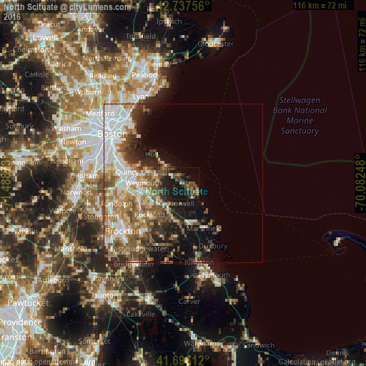
Analysis of North Scituate night lights 2016
Square area 10x10 km:
 1.06%
1.06%90-99
0.76%80-89
1.52%70-79
1.52%60-69
4.7%50-59
4.7%40-49
11.36%30-39
5.61%20-29
10.3%10-19
37.42%0-9
21.06%Square area 50x50 km:
6.28%90-99
5.05%80-89
2.77%70-79
2.8%60-69
4.72%50-59
4.79%40-49
3.89%30-39
3.11%20-29
5.3%10-19
9.25%0-9
52.04%Clear (daylight) street map image can be seen on geolist.org.
Map coordinates:
42° 44' 15.2" North, 71° 29' 19.4" West
42° 13' 8.4" North, 70° 47' 8.2" West
41° 41' 46" North, 70° 4' 56.9" West
Some cities around North Scituate sort by population:
• Weymouth
12.7 km =7.9 mi,  270°
270°
• Rockland
14.6 km =9.1 mi,  227°
227°
• Hanover
12 km =7.5 mi,  190°
190°
• Norwell
6.4 km =4 mi, 186°
• Hull
13.7 km =8.5 mi,  312°
312°
• Cohasset
2.9 km =1.8 mi,  329°
329°
• Hingham
8.9 km =5.5 mi,  286°
286°
• Scituate
5.5 km =3.4 mi,  117°
117°
4945764 (p: 5,077)
Sources (retrieved 2019-11-25):
» Earth at Night: Flat Maps 2012, 2016