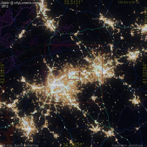
Greer night lights from space
Night Light of Greer (South Carolina) from space (United States) Src. Average luminocity for 10x10km area is 84.0531% and for 50x50km: 46.3503%.
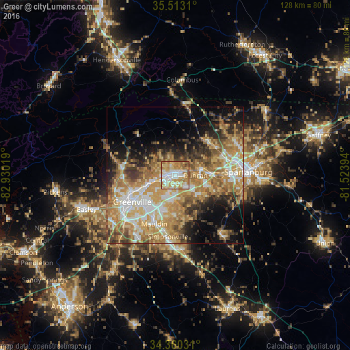
Analysis of Greer night lights 2016
Square area 10x10 km:
 22.89%
90-99
18.86%80-89
20.51%70-79
17.77%60-69
12.82%50-59
6.41%40-49
0.55%30-39
0.18%20-29
0%10-19
0%0-9
0%Square area 50x50 km:
6.82%90-99
7.12%80-89
8.74%70-79
10.29%60-69
10.19%50-59
5.98%40-49
5.05%30-39
6.19%20-29
5.62%10-19
8.92%0-9
25.08%Clear (daylight) street map image can be seen on geolist.org.
Map coordinates:
35° 30' 47.2" North, 82° 55' 48.7" West
34° 56' 19.4" North, 82° 13' 37.4" West
34° 21' 37.1" North, 81° 31' 26.2" West
Some cities around Greer sort by population:
• Greenville
18 km =11.2 mi,  237°
237°
• Mauldin
19.3 km =12 mi,  203°
203°
• Taylors
6.6 km =4.1 mi,  252°
252°
• Simpsonville
22.6 km =14 mi,  186°
186°
• Wade Hampton
10.4 km =6.5 mi, 248°
• Berea
21.7 km =13.5 mi, 254°
• Five Forks
14.9 km =9.3 mi,  180°
180°
• Sans Souci
19.2 km =11.9 mi, 249°
4580599 (p: 28,365)
Sources (retrieved 2019-11-25):
» Earth at Night: Flat Maps 2012, 2016