Sans Souci night lights from space
Night Light of Sans Souci (South Carolina) from space (United States) Src. Average luminocity for 10x10km area is 83.7582% and for 50x50km: 43.0886%.
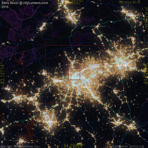
Analysis of Sans Souci night lights 2016
Square area 10x10 km:
 22.71%
90-99
23.63%80-89
15.02%70-79
15.2%60-69
16.67%50-59
3.85%40-49
2.93%30-39
0%20-29
0%10-19
0%0-9
0%Square area 50x50 km:
5.92%90-99
6.09%80-89
8.29%70-79
8.88%60-69
8.67%50-59
5.86%40-49
6.09%30-39
7.14%20-29
7.87%10-19
8.87%0-9
26.31%Clear (daylight) street map image can be seen on geolist.org.
Map coordinates:
35° 27' 9.7" North, 83° 7' 37.7" West
34° 52' 40.4" North, 82° 25' 26.4" West
34° 17' 56.6" North, 81° 43' 15.2" West
Some cities around Sans Souci sort by population:
• Greenville
3.9 km =2.4 mi,  135°
135°
• Taylors
12.6 km =7.8 mi,  67°
67°
• Wade Hampton
8.8 km =5.5 mi, 70°
• Berea
3 km =1.9 mi,  285°
285°
• Gantt
8.6 km =5.3 mi,  180°
180°
• Parker
4 km =2.5 mi,  221°
221°
• Powdersville
11.5 km =7.1 mi,  213°
213°
• Welcome
5.9 km =3.7 mi,  193°
193°
4594975 (p: 7,869)
Sources (retrieved 2019-11-25):
» Earth at Night: Flat Maps 2012, 2016